You are here: Home > Network List > TA - USArray Transportable Network (new EarthScope stations) Stations List
> Station P17K Kvichak River, AK, USA > Earthquake Result Viewer
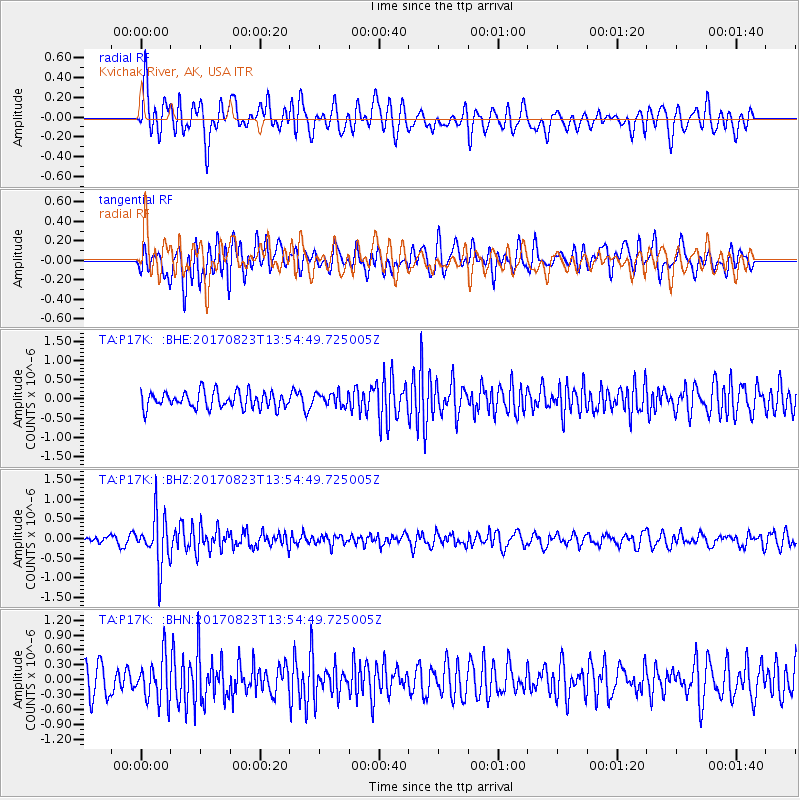
P17K Kvichak River, AK, USA - Earthquake Result Viewer
*The percent match for this event was below the threshold and hence no stack was calculated.
| Earthquake location: |
Iran-Iraq Border Region |
| Earthquake latitude/longitude: |
36.2/45.0 |
| Earthquake time(UTC): |
2017/08/23 (235) 13:42:53 GMT |
| Earthquake Depth: |
10 km |
| Earthquake Magnitude: |
5.6 mb |
| Earthquake Catalog/Contributor: |
NEIC PDE/us |
|
| Network: |
TA USArray Transportable Network (new EarthScope stations) |
| Station: |
P17K Kvichak River, AK, USA |
| Lat/Lon: |
59.20 N/156.44 W |
| Elevation: |
91 m |
|
| Distance: |
83.3 deg |
| Az: |
10.904 deg |
| Baz: |
342.694 deg |
| Ray Param: |
$rayparam |
*The percent match for this event was below the threshold and hence was not used in the summary stack. |
|
| Radial Match: |
62.43461 % |
| Radial Bump: |
400 |
| Transverse Match: |
66.95336 % |
| Transverse Bump: |
400 |
| SOD ConfigId: |
13570011 |
| Insert Time: |
2019-04-28 15:30:07.106 +0000 |
| GWidth: |
2.5 |
| Max Bumps: |
400 |
| Tol: |
0.001 |
|
Signal To Noise
| Channel | StoN | STA | LTA |
| TA:P17K: :BHZ:20170823T13:54:49.725005Z | 6.2693825 | 6.4462614E-7 | 1.0282131E-7 |
| TA:P17K: :BHN:20170823T13:54:49.725005Z | 1.9686948 | 4.448134E-7 | 2.259433E-7 |
| TA:P17K: :BHE:20170823T13:54:49.725005Z | 0.77550703 | 1.6467705E-7 | 2.1234759E-7 |
| Arrivals |
| Ps | |
| PpPs | |
| PsPs/PpSs | |


