You are here: Home > Network List > TA - USArray Transportable Network (new EarthScope stations) Stations List
> Station 124A Stringfield Ranch, Weed, NM, USA > Earthquake Result Viewer
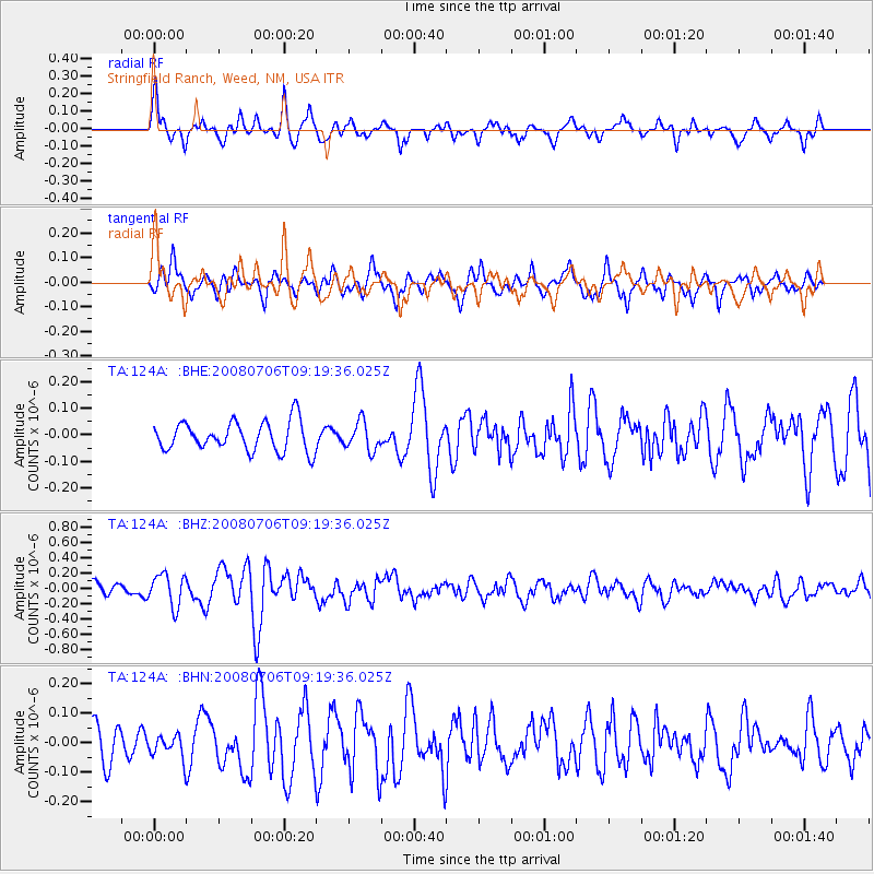
124A Stringfield Ranch, Weed, NM, USA - Earthquake Result Viewer
*The percent match for this event was below the threshold and hence no stack was calculated.
| Earthquake location: |
Kuril Islands |
| Earthquake latitude/longitude: |
45.4/151.0 |
| Earthquake time(UTC): |
2008/07/06 (188) 09:08:20 GMT |
| Earthquake Depth: |
10 km |
| Earthquake Magnitude: |
5.8 MB, 5.4 MS, 5.7 MW, 5.7 MW |
| Earthquake Catalog/Contributor: |
WHDF/NEIC |
|
| Network: |
TA USArray Transportable Network (new EarthScope stations) |
| Station: |
124A Stringfield Ranch, Weed, NM, USA |
| Lat/Lon: |
32.70 N/105.45 W |
| Elevation: |
2078 m |
|
| Distance: |
76.0 deg |
| Az: |
57.633 deg |
| Baz: |
315.095 deg |
| Ray Param: |
$rayparam |
*The percent match for this event was below the threshold and hence was not used in the summary stack. |
|
| Radial Match: |
76.2506 % |
| Radial Bump: |
400 |
| Transverse Match: |
63.712734 % |
| Transverse Bump: |
400 |
| SOD ConfigId: |
2504 |
| Insert Time: |
2010-03-06 03:04:26.384 +0000 |
| GWidth: |
2.5 |
| Max Bumps: |
400 |
| Tol: |
0.001 |
|
Signal To Noise
| Channel | StoN | STA | LTA |
| TA:124A: :BHZ:20080706T09:19:36.025Z | 2.0826836 | 2.0791585E-7 | 9.983074E-8 |
| TA:124A: :BHN:20080706T09:19:36.025Z | 0.6207894 | 3.748401E-8 | 6.0381204E-8 |
| TA:124A: :BHE:20080706T09:19:36.025Z | 0.96419865 | 5.3302575E-8 | 5.5281735E-8 |
| Arrivals |
| Ps | |
| PpPs | |
| PsPs/PpSs | |


