You are here: Home > Network List > TA - USArray Transportable Network (new EarthScope stations) Stations List
> Station 124A Stringfield Ranch, Weed, NM, USA > Earthquake Result Viewer
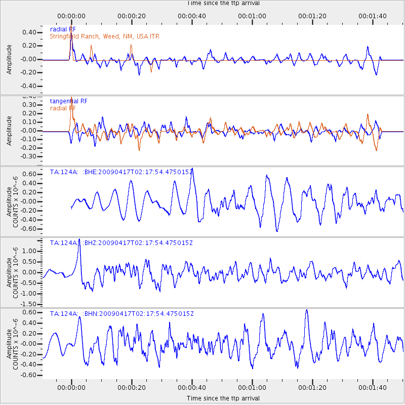
124A Stringfield Ranch, Weed, NM, USA - Earthquake Result Viewer
*The percent match for this event was below the threshold and hence no stack was calculated.
| Earthquake location: |
Near Coast Of Northern Chile |
| Earthquake latitude/longitude: |
-19.6/-70.5 |
| Earthquake time(UTC): |
2009/04/17 (107) 02:08:08 GMT |
| Earthquake Depth: |
25 km |
| Earthquake Magnitude: |
5.8 MB, 5.8 MS, 6.1 MW, 6.1 MW |
| Earthquake Catalog/Contributor: |
WHDF/NEIC |
|
| Network: |
TA USArray Transportable Network (new EarthScope stations) |
| Station: |
124A Stringfield Ranch, Weed, NM, USA |
| Lat/Lon: |
32.70 N/105.45 W |
| Elevation: |
2078 m |
|
| Distance: |
61.8 deg |
| Az: |
326.752 deg |
| Baz: |
142.186 deg |
| Ray Param: |
$rayparam |
*The percent match for this event was below the threshold and hence was not used in the summary stack. |
|
| Radial Match: |
58.276775 % |
| Radial Bump: |
400 |
| Transverse Match: |
62.275112 % |
| Transverse Bump: |
400 |
| SOD ConfigId: |
2658 |
| Insert Time: |
2010-03-06 03:04:31.743 +0000 |
| GWidth: |
2.5 |
| Max Bumps: |
400 |
| Tol: |
0.001 |
|
Signal To Noise
| Channel | StoN | STA | LTA |
| TA:124A: :BHZ:20090417T02:17:54.475015Z | 5.9145293 | 6.443621E-7 | 1.0894563E-7 |
| TA:124A: :BHN:20090417T02:17:54.475015Z | 1.5110369 | 2.6101668E-7 | 1.7274012E-7 |
| TA:124A: :BHE:20090417T02:17:54.475015Z | 1.1748595 | 2.334757E-7 | 1.9872648E-7 |
| Arrivals |
| Ps | |
| PpPs | |
| PsPs/PpSs | |


