You are here: Home > Network List > TA - USArray Transportable Network (new EarthScope stations) Stations List
> Station B22K Teshekpuk Lake, AK, USA > Earthquake Result Viewer
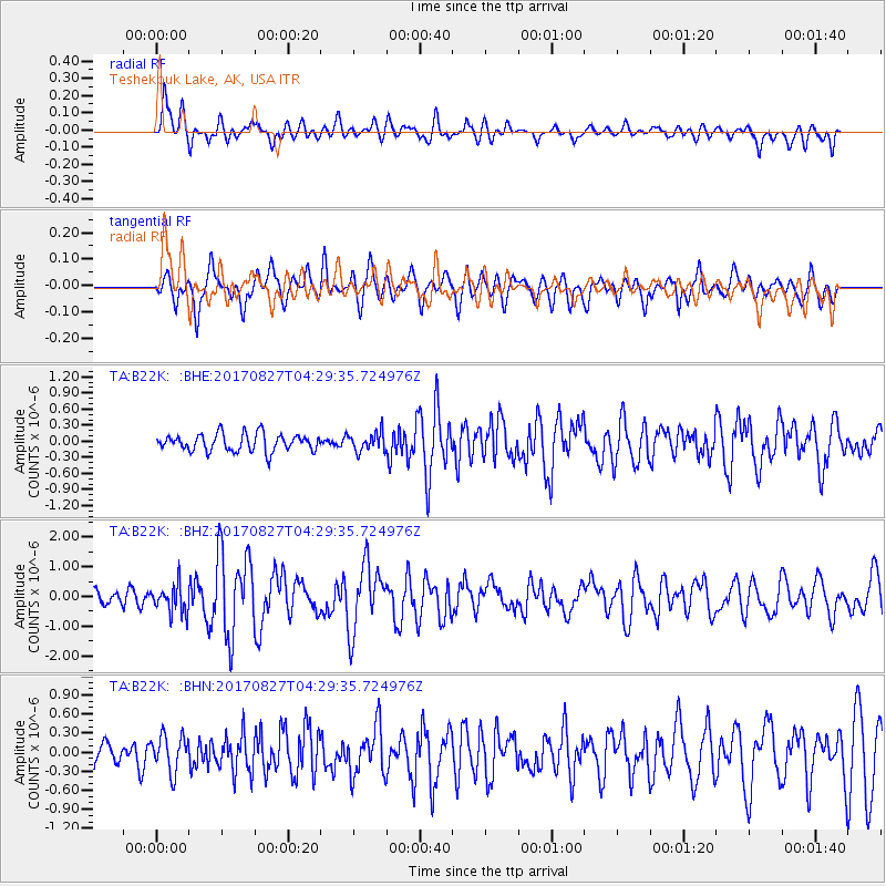
B22K Teshekpuk Lake, AK, USA - Earthquake Result Viewer
*The percent match for this event was below the threshold and hence no stack was calculated.
| Earthquake location: |
Admiralty Islands Region, P.N.G. |
| Earthquake latitude/longitude: |
-1.4/148.1 |
| Earthquake time(UTC): |
2017/08/27 (239) 04:17:51 GMT |
| Earthquake Depth: |
10 km |
| Earthquake Magnitude: |
6.6 Mi |
| Earthquake Catalog/Contributor: |
NEIC PDE/at |
|
| Network: |
TA USArray Transportable Network (new EarthScope stations) |
| Station: |
B22K Teshekpuk Lake, AK, USA |
| Lat/Lon: |
70.34 N/153.42 W |
| Elevation: |
50 m |
|
| Distance: |
81.1 deg |
| Az: |
16.978 deg |
| Baz: |
239.599 deg |
| Ray Param: |
$rayparam |
*The percent match for this event was below the threshold and hence was not used in the summary stack. |
|
| Radial Match: |
68.12986 % |
| Radial Bump: |
400 |
| Transverse Match: |
71.34497 % |
| Transverse Bump: |
400 |
| SOD ConfigId: |
13570011 |
| Insert Time: |
2019-04-28 15:38:58.278 +0000 |
| GWidth: |
2.5 |
| Max Bumps: |
400 |
| Tol: |
0.001 |
|
Signal To Noise
| Channel | StoN | STA | LTA |
| TA:B22K: :BHZ:20170827T04:29:35.724976Z | 2.0321288 | 4.7400295E-7 | 2.3325438E-7 |
| TA:B22K: :BHN:20170827T04:29:35.724976Z | 1.4586854 | 2.8878313E-7 | 1.9797491E-7 |
| TA:B22K: :BHE:20170827T04:29:35.724976Z | 1.0354705 | 1.6810759E-7 | 1.62349E-7 |
| Arrivals |
| Ps | |
| PpPs | |
| PsPs/PpSs | |


