You are here: Home > Network List > TA - USArray Transportable Network (new EarthScope stations) Stations List
> Station 124A Stringfield Ranch, Weed, NM, USA > Earthquake Result Viewer
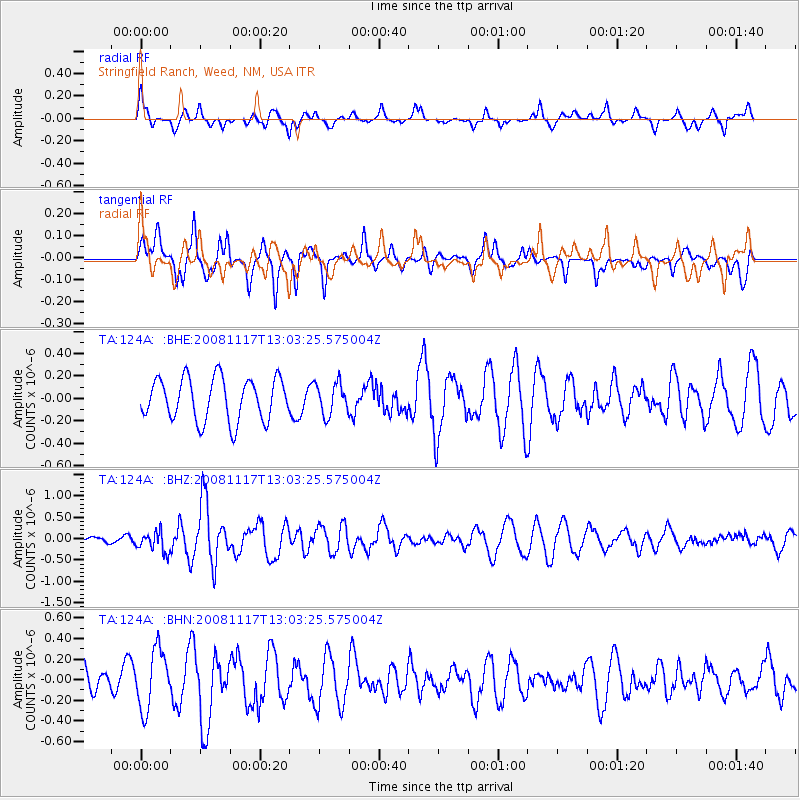
124A Stringfield Ranch, Weed, NM, USA - Earthquake Result Viewer
*The percent match for this event was below the threshold and hence no stack was calculated.
| Earthquake location: |
Arctic Ocean |
| Earthquake latitude/longitude: |
79.6/-116.1 |
| Earthquake time(UTC): |
2008/11/17 (322) 12:55:22 GMT |
| Earthquake Depth: |
7.0 km |
| Earthquake Magnitude: |
5.7 MW, 5.2 MS, 5.4 MB, 5.7 MW |
| Earthquake Catalog/Contributor: |
WHDF/NEIC |
|
| Network: |
TA USArray Transportable Network (new EarthScope stations) |
| Station: |
124A Stringfield Ranch, Weed, NM, USA |
| Lat/Lon: |
32.70 N/105.45 W |
| Elevation: |
2078 m |
|
| Distance: |
47.3 deg |
| Az: |
167.806 deg |
| Baz: |
357.403 deg |
| Ray Param: |
$rayparam |
*The percent match for this event was below the threshold and hence was not used in the summary stack. |
|
| Radial Match: |
57.92686 % |
| Radial Bump: |
336 |
| Transverse Match: |
59.254253 % |
| Transverse Bump: |
338 |
| SOD ConfigId: |
2658 |
| Insert Time: |
2010-03-06 03:04:49.914 +0000 |
| GWidth: |
2.5 |
| Max Bumps: |
400 |
| Tol: |
0.001 |
|
Signal To Noise
| Channel | StoN | STA | LTA |
| TA:124A: :BHZ:20081117T13:03:25.575004Z | 1.7379748 | 2.355214E-7 | 1.3551485E-7 |
| TA:124A: :BHN:20081117T13:03:25.575004Z | 2.019791 | 2.8666963E-7 | 1.4193034E-7 |
| TA:124A: :BHE:20081117T13:03:25.575004Z | 0.74917394 | 1.411032E-7 | 1.8834504E-7 |
| Arrivals |
| Ps | |
| PpPs | |
| PsPs/PpSs | |


