You are here: Home > Network List > TA - USArray Transportable Network (new EarthScope stations) Stations List
> Station 124A Stringfield Ranch, Weed, NM, USA > Earthquake Result Viewer
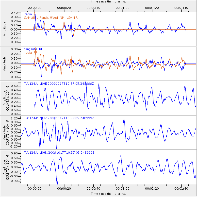
124A Stringfield Ranch, Weed, NM, USA - Earthquake Result Viewer
*The percent match for this event was below the threshold and hence no stack was calculated.
| Earthquake location: |
Samoa Islands Region |
| Earthquake latitude/longitude: |
-16.4/-172.0 |
| Earthquake time(UTC): |
2009/10/17 (290) 10:45:26 GMT |
| Earthquake Depth: |
10 km |
| Earthquake Magnitude: |
5.7 MB, 5.3 MS, 5.7 MW, 5.7 MW |
| Earthquake Catalog/Contributor: |
WHDF/NEIC |
|
| Network: |
TA USArray Transportable Network (new EarthScope stations) |
| Station: |
124A Stringfield Ranch, Weed, NM, USA |
| Lat/Lon: |
32.70 N/105.45 W |
| Elevation: |
2078 m |
|
| Distance: |
80.1 deg |
| Az: |
51.728 deg |
| Baz: |
243.365 deg |
| Ray Param: |
$rayparam |
*The percent match for this event was below the threshold and hence was not used in the summary stack. |
|
| Radial Match: |
52.734413 % |
| Radial Bump: |
400 |
| Transverse Match: |
52.012436 % |
| Transverse Bump: |
378 |
| SOD ConfigId: |
2622 |
| Insert Time: |
2010-03-06 03:05:09.699 +0000 |
| GWidth: |
2.5 |
| Max Bumps: |
400 |
| Tol: |
0.001 |
|
Signal To Noise
| Channel | StoN | STA | LTA |
| TA:124A: :BHZ:20091017T10:57:05.248999Z | 3.8281345 | 5.9684476E-7 | 1.5591007E-7 |
| TA:124A: :BHN:20091017T10:57:05.248999Z | 0.60139054 | 1.0909992E-7 | 1.8141276E-7 |
| TA:124A: :BHE:20091017T10:57:05.248999Z | 0.899643 | 2.6934808E-7 | 2.993944E-7 |
| Arrivals |
| Ps | |
| PpPs | |
| PsPs/PpSs | |


