You are here: Home > Network List > US - United States National Seismic Network Stations List
> Station WUAZ Wupatki, Arizona, USA > Earthquake Result Viewer
WUAZ Wupatki, Arizona, USA - Earthquake Result Viewer

| Earthquake location: |
Kamchatka Peninsula, Russia |
| Earthquake latitude/longitude: |
54.0/158.5 |
| Earthquake time(UTC): |
2016/01/30 (030) 03:25:10 GMT |
| Earthquake Depth: |
161 km |
| Earthquake Magnitude: |
7.2 MWW, 7.0 MI, 7.2 MWB |
| Earthquake Catalog/Contributor: |
NEIC PDE/NEIC COMCAT |
|
| Network: |
US United States National Seismic Network |
| Station: |
WUAZ Wupatki, Arizona, USA |
| Lat/Lon: |
35.52 N/111.37 W |
| Elevation: |
1592 m |
|
| Distance: |
62.2 deg |
| Az: |
67.21 deg |
| Baz: |
318.159 deg |
| Ray Param: |
0.059877586 |
| Estimated Moho Depth: |
38.75 km |
| Estimated Crust Vp/Vs: |
2.02 |
| Assumed Crust Vp: |
6.207 km/s |
| Estimated Crust Vs: |
3.073 km/s |
| Estimated Crust Poisson's Ratio: |
0.34 |
|
| Radial Match: |
94.71486 % |
| Radial Bump: |
400 |
| Transverse Match: |
84.65253 % |
| Transverse Bump: |
400 |
| SOD ConfigId: |
1427151 |
| Insert Time: |
2016-02-13 04:19:53.235 +0000 |
| GWidth: |
2.5 |
| Max Bumps: |
400 |
| Tol: |
0.001 |
|
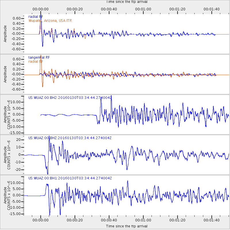
Signal To Noise
| Channel | StoN | STA | LTA |
| US:WUAZ:00:BHZ:20160130T03:34:44.274004Z | 25.59632 | 1.0809973E-5 | 4.223253E-7 |
| US:WUAZ:00:BH1:20160130T03:34:44.274004Z | 29.612673 | 4.4796766E-6 | 1.5127566E-7 |
| US:WUAZ:00:BH2:20160130T03:34:44.274004Z | 8.402204 | 3.2522041E-6 | 3.870656E-7 |
| Arrivals |
| Ps | 6.6 SECOND |
| PpPs | 18 SECOND |
| PsPs/PpSs | 25 SECOND |


