You are here: Home > Network List > CI - Caltech Regional Seismic Network Stations List
> Station MPM Manuel Prospect Mine, California, USA > Earthquake Result Viewer
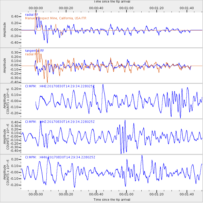
MPM Manuel Prospect Mine, California, USA - Earthquake Result Viewer
*The percent match for this event was below the threshold and hence no stack was calculated.
| Earthquake location: |
Azores Islands Region |
| Earthquake latitude/longitude: |
40.0/-29.4 |
| Earthquake time(UTC): |
2017/08/30 (242) 14:19:14 GMT |
| Earthquake Depth: |
10 km |
| Earthquake Magnitude: |
5.6 Mww |
| Earthquake Catalog/Contributor: |
NEIC PDE/us |
|
| Network: |
CI Caltech Regional Seismic Network |
| Station: |
MPM Manuel Prospect Mine, California, USA |
| Lat/Lon: |
36.06 N/117.49 W |
| Elevation: |
185 m |
|
| Distance: |
66.7 deg |
| Az: |
298.112 deg |
| Baz: |
56.723 deg |
| Ray Param: |
$rayparam |
*The percent match for this event was below the threshold and hence was not used in the summary stack. |
|
| Radial Match: |
66.6017 % |
| Radial Bump: |
400 |
| Transverse Match: |
62.37871 % |
| Transverse Bump: |
400 |
| SOD ConfigId: |
13570011 |
| Insert Time: |
2019-04-28 15:43:15.217 +0000 |
| GWidth: |
2.5 |
| Max Bumps: |
400 |
| Tol: |
0.001 |
|
Signal To Noise
| Channel | StoN | STA | LTA |
| CI:MPM: :HHZ:20170830T14:29:34.228025Z | 2.8876684 | 1.9358549E-7 | 6.7038684E-8 |
| CI:MPM: :HHN:20170830T14:29:34.228025Z | 1.6462116 | 1.0215015E-7 | 6.2051654E-8 |
| CI:MPM: :HHE:20170830T14:29:34.228025Z | 1.2356606 | 8.845517E-8 | 7.1585326E-8 |
| Arrivals |
| Ps | |
| PpPs | |
| PsPs/PpSs | |


