You are here: Home > Network List > UW - Pacific Northwest Regional Seismic Network Stations List
> Station UMAT Pilot Rock, OR, USA > Earthquake Result Viewer
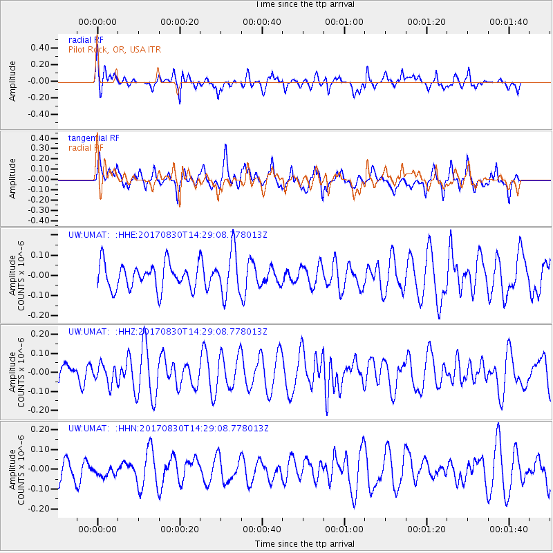
UMAT Pilot Rock, OR, USA - Earthquake Result Viewer
*The percent match for this event was below the threshold and hence no stack was calculated.
| Earthquake location: |
Azores Islands Region |
| Earthquake latitude/longitude: |
40.0/-29.4 |
| Earthquake time(UTC): |
2017/08/30 (242) 14:19:14 GMT |
| Earthquake Depth: |
10 km |
| Earthquake Magnitude: |
5.6 Mww |
| Earthquake Catalog/Contributor: |
NEIC PDE/us |
|
| Network: |
UW Pacific Northwest Regional Seismic Network |
| Station: |
UMAT Pilot Rock, OR, USA |
| Lat/Lon: |
45.29 N/118.96 W |
| Elevation: |
1318 m |
|
| Distance: |
62.7 deg |
| Az: |
307.437 deg |
| Baz: |
59.76 deg |
| Ray Param: |
$rayparam |
*The percent match for this event was below the threshold and hence was not used in the summary stack. |
|
| Radial Match: |
57.596195 % |
| Radial Bump: |
400 |
| Transverse Match: |
62.79687 % |
| Transverse Bump: |
400 |
| SOD ConfigId: |
13570011 |
| Insert Time: |
2019-04-28 15:49:28.570 +0000 |
| GWidth: |
2.5 |
| Max Bumps: |
400 |
| Tol: |
0.001 |
|
Signal To Noise
| Channel | StoN | STA | LTA |
| UW:UMAT: :HHZ:20170830T14:29:08.778013Z | 0.78034705 | 5.192678E-8 | 6.654319E-8 |
| UW:UMAT: :HHN:20170830T14:29:08.778013Z | 0.38220116 | 2.6235664E-8 | 6.86436E-8 |
| UW:UMAT: :HHE:20170830T14:29:08.778013Z | 1.8037957 | 1.12949074E-7 | 6.261744E-8 |
| Arrivals |
| Ps | |
| PpPs | |
| PsPs/PpSs | |


