You are here: Home > Network List > TA - USArray Transportable Network (new EarthScope stations) Stations List
> Station 124A Stringfield Ranch, Weed, NM, USA > Earthquake Result Viewer
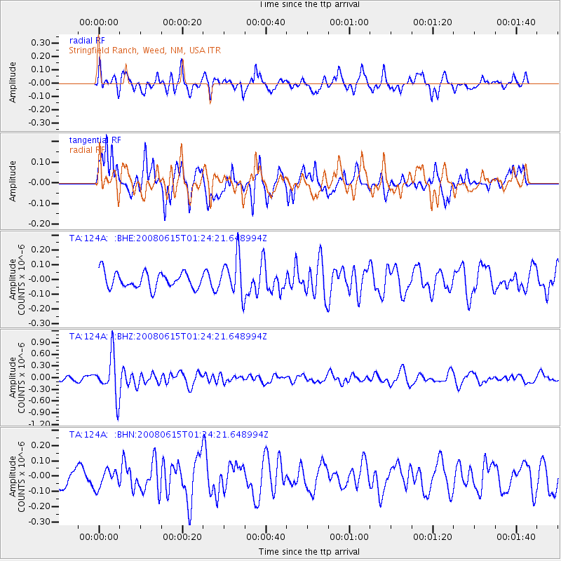
124A Stringfield Ranch, Weed, NM, USA - Earthquake Result Viewer
*The percent match for this event was below the threshold and hence no stack was calculated.
| Earthquake location: |
Fiji Islands Region |
| Earthquake latitude/longitude: |
-17.7/-179.7 |
| Earthquake time(UTC): |
2008/06/15 (167) 01:13:11 GMT |
| Earthquake Depth: |
611 km |
| Earthquake Magnitude: |
5.5 MB, 5.9 MW, 5.9 MW |
| Earthquake Catalog/Contributor: |
WHDF/NEIC |
|
| Network: |
TA USArray Transportable Network (new EarthScope stations) |
| Station: |
124A Stringfield Ranch, Weed, NM, USA |
| Lat/Lon: |
32.70 N/105.45 W |
| Elevation: |
2078 m |
|
| Distance: |
86.8 deg |
| Az: |
54.374 deg |
| Baz: |
246.751 deg |
| Ray Param: |
$rayparam |
*The percent match for this event was below the threshold and hence was not used in the summary stack. |
|
| Radial Match: |
59.09154 % |
| Radial Bump: |
396 |
| Transverse Match: |
60.46537 % |
| Transverse Bump: |
400 |
| SOD ConfigId: |
2504 |
| Insert Time: |
2010-03-06 03:05:50.389 +0000 |
| GWidth: |
2.5 |
| Max Bumps: |
400 |
| Tol: |
0.001 |
|
Signal To Noise
| Channel | StoN | STA | LTA |
| TA:124A: :BHZ:20080615T01:24:21.648994Z | 5.45679 | 5.3210596E-7 | 9.751263E-8 |
| TA:124A: :BHN:20080615T01:24:21.648994Z | 0.8387389 | 5.837801E-8 | 6.960212E-8 |
| TA:124A: :BHE:20080615T01:24:21.648994Z | 2.5449927 | 1.3520773E-7 | 5.3126964E-8 |
| Arrivals |
| Ps | |
| PpPs | |
| PsPs/PpSs | |


