You are here: Home > Network List > TA - USArray Transportable Network (new EarthScope stations) Stations List
> Station K13K Kusilvak Mountain, AK, USA > Earthquake Result Viewer
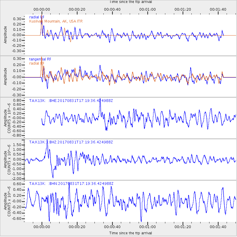
K13K Kusilvak Mountain, AK, USA - Earthquake Result Viewer
*The percent match for this event was below the threshold and hence no stack was calculated.
| Earthquake location: |
Southern Sumatra, Indonesia |
| Earthquake latitude/longitude: |
-1.2/99.7 |
| Earthquake time(UTC): |
2017/08/31 (243) 17:06:55 GMT |
| Earthquake Depth: |
43 km |
| Earthquake Magnitude: |
6.3 Mww |
| Earthquake Catalog/Contributor: |
NEIC PDE/us |
|
| Network: |
TA USArray Transportable Network (new EarthScope stations) |
| Station: |
K13K Kusilvak Mountain, AK, USA |
| Lat/Lon: |
61.93 N/164.66 W |
| Elevation: |
204 m |
|
| Distance: |
93.7 deg |
| Az: |
28.141 deg |
| Baz: |
274.444 deg |
| Ray Param: |
$rayparam |
*The percent match for this event was below the threshold and hence was not used in the summary stack. |
|
| Radial Match: |
65.10445 % |
| Radial Bump: |
400 |
| Transverse Match: |
60.878235 % |
| Transverse Bump: |
400 |
| SOD ConfigId: |
13570011 |
| Insert Time: |
2019-04-28 15:53:42.619 +0000 |
| GWidth: |
2.5 |
| Max Bumps: |
400 |
| Tol: |
0.001 |
|
Signal To Noise
| Channel | StoN | STA | LTA |
| TA:K13K: :BHZ:20170831T17:19:36.424988Z | 4.090829 | 8.130637E-7 | 1.9875282E-7 |
| TA:K13K: :BHN:20170831T17:19:36.424988Z | 1.1195773 | 2.2948336E-7 | 2.0497322E-7 |
| TA:K13K: :BHE:20170831T17:19:36.424988Z | 1.916967 | 2.964886E-7 | 1.5466547E-7 |
| Arrivals |
| Ps | |
| PpPs | |
| PsPs/PpSs | |


