You are here: Home > Network List > TA - USArray Transportable Network (new EarthScope stations) Stations List
> Station O17K Koliganek, Bristol Bay, AK, USA > Earthquake Result Viewer
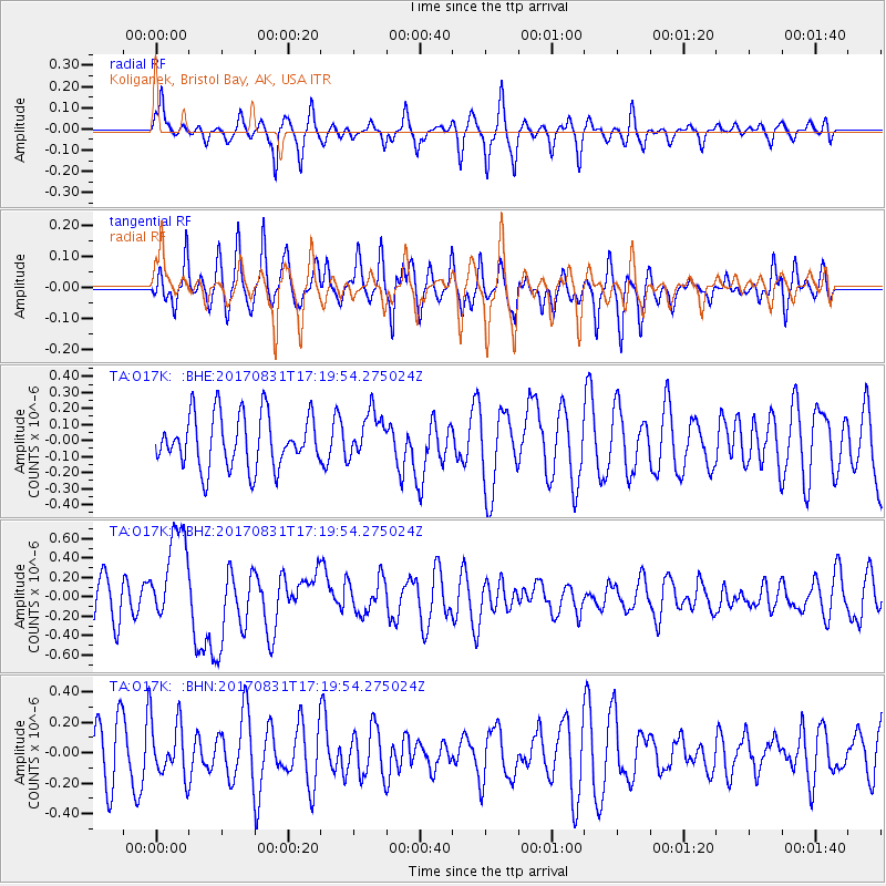
O17K Koliganek, Bristol Bay, AK, USA - Earthquake Result Viewer
*The percent match for this event was below the threshold and hence no stack was calculated.
| Earthquake location: |
Southern Sumatra, Indonesia |
| Earthquake latitude/longitude: |
-1.2/99.7 |
| Earthquake time(UTC): |
2017/08/31 (243) 17:06:55 GMT |
| Earthquake Depth: |
43 km |
| Earthquake Magnitude: |
6.3 Mww |
| Earthquake Catalog/Contributor: |
NEIC PDE/us |
|
| Network: |
TA USArray Transportable Network (new EarthScope stations) |
| Station: |
O17K Koliganek, Bristol Bay, AK, USA |
| Lat/Lon: |
59.77 N/157.09 W |
| Elevation: |
156 m |
|
| Distance: |
97.6 deg |
| Az: |
29.799 deg |
| Baz: |
280.876 deg |
| Ray Param: |
$rayparam |
*The percent match for this event was below the threshold and hence was not used in the summary stack. |
|
| Radial Match: |
50.248302 % |
| Radial Bump: |
292 |
| Transverse Match: |
56.995094 % |
| Transverse Bump: |
314 |
| SOD ConfigId: |
13570011 |
| Insert Time: |
2019-04-28 15:53:53.686 +0000 |
| GWidth: |
2.5 |
| Max Bumps: |
400 |
| Tol: |
0.001 |
|
Signal To Noise
| Channel | StoN | STA | LTA |
| TA:O17K: :BHZ:20170831T17:19:54.275024Z | 2.7479005 | 4.8807175E-7 | 1.7761623E-7 |
| TA:O17K: :BHN:20170831T17:19:54.275024Z | 0.917031 | 1.830333E-7 | 1.9959336E-7 |
| TA:O17K: :BHE:20170831T17:19:54.275024Z | 0.8657873 | 1.4326491E-7 | 1.6547358E-7 |
| Arrivals |
| Ps | |
| PpPs | |
| PsPs/PpSs | |


