You are here: Home > Network List > TA - USArray Transportable Network (new EarthScope stations) Stations List
> Station P17K Kvichak River, AK, USA > Earthquake Result Viewer
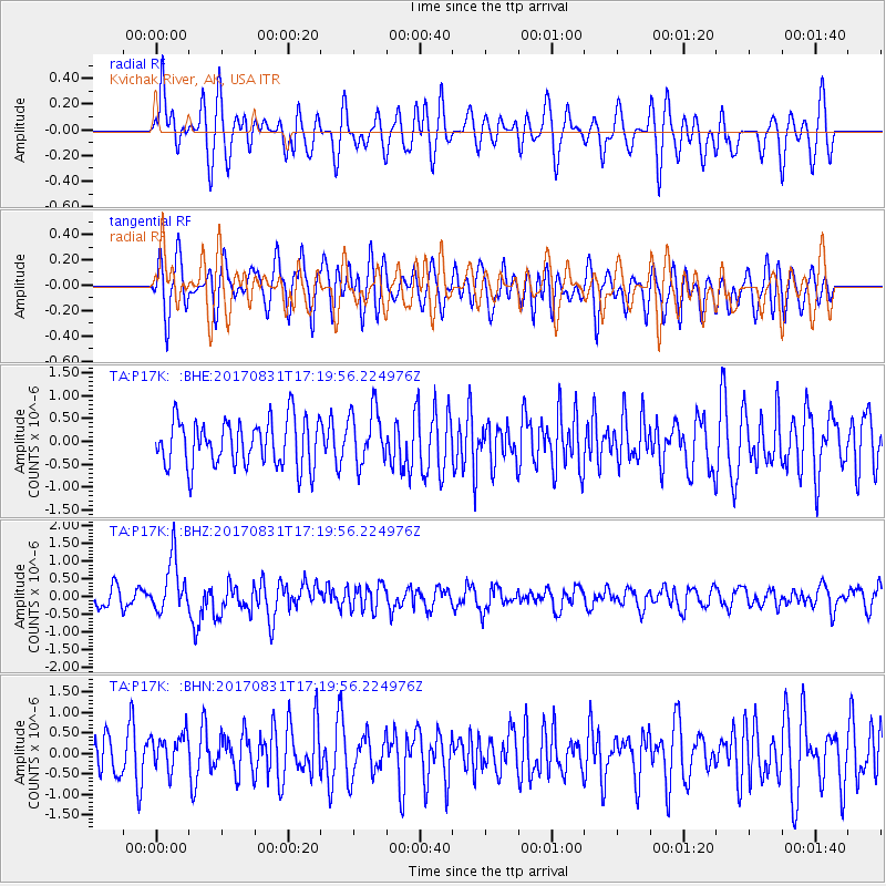
P17K Kvichak River, AK, USA - Earthquake Result Viewer
*The percent match for this event was below the threshold and hence no stack was calculated.
| Earthquake location: |
Southern Sumatra, Indonesia |
| Earthquake latitude/longitude: |
-1.2/99.7 |
| Earthquake time(UTC): |
2017/08/31 (243) 17:06:55 GMT |
| Earthquake Depth: |
43 km |
| Earthquake Magnitude: |
6.3 Mww |
| Earthquake Catalog/Contributor: |
NEIC PDE/us |
|
| Network: |
TA USArray Transportable Network (new EarthScope stations) |
| Station: |
P17K Kvichak River, AK, USA |
| Lat/Lon: |
59.20 N/156.44 W |
| Elevation: |
91 m |
|
| Distance: |
98.1 deg |
| Az: |
30.308 deg |
| Baz: |
281.37 deg |
| Ray Param: |
$rayparam |
*The percent match for this event was below the threshold and hence was not used in the summary stack. |
|
| Radial Match: |
56.0286 % |
| Radial Bump: |
400 |
| Transverse Match: |
57.630444 % |
| Transverse Bump: |
400 |
| SOD ConfigId: |
13570011 |
| Insert Time: |
2019-04-28 15:53:55.101 +0000 |
| GWidth: |
2.5 |
| Max Bumps: |
400 |
| Tol: |
0.001 |
|
Signal To Noise
| Channel | StoN | STA | LTA |
| TA:P17K: :BHZ:20170831T17:19:56.224976Z | 3.344559 | 7.3752244E-7 | 2.2051411E-7 |
| TA:P17K: :BHN:20170831T17:19:56.224976Z | 0.8403441 | 4.310286E-7 | 5.129192E-7 |
| TA:P17K: :BHE:20170831T17:19:56.224976Z | 1.1879122 | 6.089205E-7 | 5.125972E-7 |
| Arrivals |
| Ps | |
| PpPs | |
| PsPs/PpSs | |


