You are here: Home > Network List > AZ - ANZA Regional Network Stations List
> Station FRD AZ.FRD > Earthquake Result Viewer
FRD AZ.FRD - Earthquake Result Viewer
*The percent match for this event was below the threshold and hence no stack was calculated.
| Earthquake location: |
Kodiak Island Region, Alaska |
| Earthquake latitude/longitude: |
58.5/-153.7 |
| Earthquake time(UTC): |
2017/08/31 (243) 17:46:02 GMT |
| Earthquake Depth: |
62 km |
| Earthquake Magnitude: |
5.5 ml |
| Earthquake Catalog/Contributor: |
NEIC PDE/ak |
|
| Network: |
AZ ANZA Regional Network |
| Station: |
FRD AZ.FRD |
| Lat/Lon: |
33.49 N/116.60 W |
| Elevation: |
1164 m |
|
| Distance: |
35.1 deg |
| Az: |
118.951 deg |
| Baz: |
326.594 deg |
| Ray Param: |
$rayparam |
*The percent match for this event was below the threshold and hence was not used in the summary stack. |
|
| Radial Match: |
50.87248 % |
| Radial Bump: |
400 |
| Transverse Match: |
52.693245 % |
| Transverse Bump: |
374 |
| SOD ConfigId: |
13570011 |
| Insert Time: |
2019-04-28 15:54:56.507 +0000 |
| GWidth: |
2.5 |
| Max Bumps: |
400 |
| Tol: |
0.001 |
|
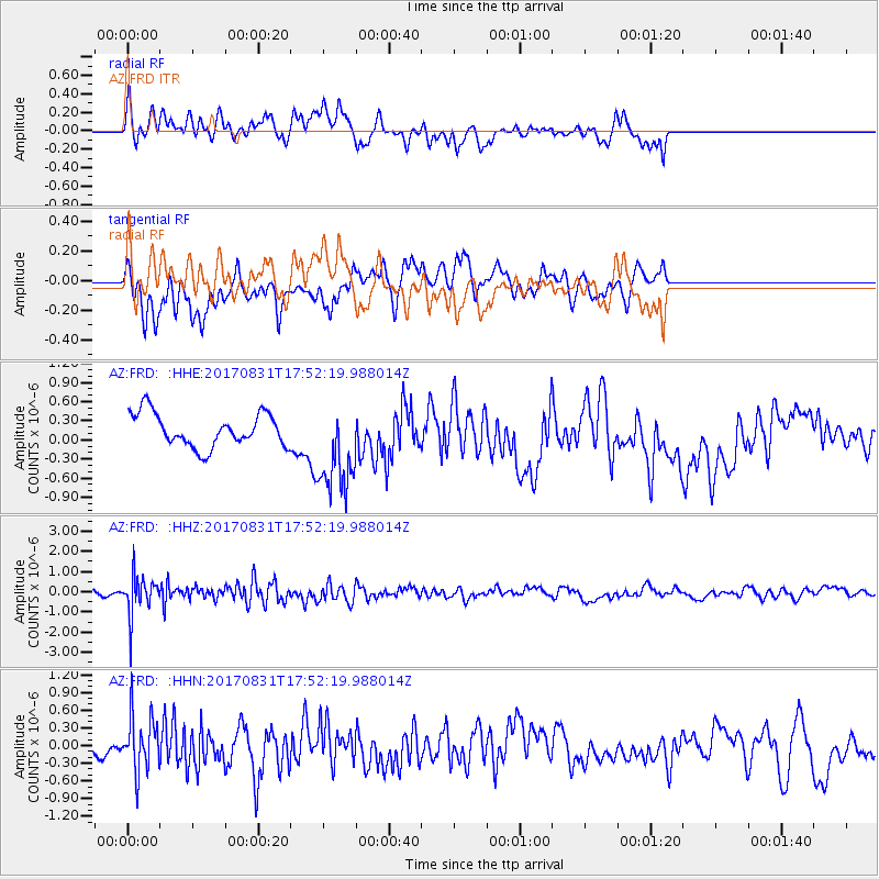
Signal To Noise
| Channel | StoN | STA | LTA |
| AZ:FRD: :HHZ:20170831T17:52:19.988014Z | 5.290705 | 9.657338E-7 | 1.8253404E-7 |
| AZ:FRD: :HHN:20170831T17:52:19.988014Z | 3.4697568 | 4.696409E-7 | 1.3535268E-7 |
| AZ:FRD: :HHE:20170831T17:52:19.988014Z | 2.725269 | 7.1053194E-7 | 2.607199E-7 |
| Arrivals |
| Ps | |
| PpPs | |
| PsPs/PpSs | |


