You are here: Home > Network List > CI - Caltech Regional Seismic Network Stations List
> Station BAR Barrett, Tecate, CA, USA > Earthquake Result Viewer
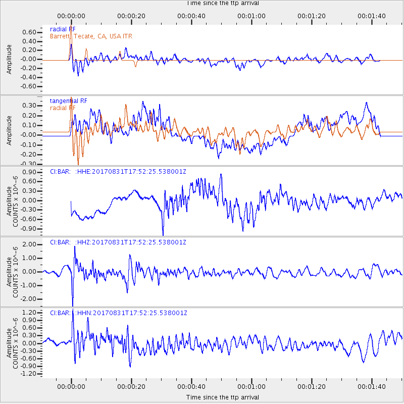
BAR Barrett, Tecate, CA, USA - Earthquake Result Viewer
*The percent match for this event was below the threshold and hence no stack was calculated.
| Earthquake location: |
Kodiak Island Region, Alaska |
| Earthquake latitude/longitude: |
58.5/-153.7 |
| Earthquake time(UTC): |
2017/08/31 (243) 17:46:02 GMT |
| Earthquake Depth: |
62 km |
| Earthquake Magnitude: |
5.5 ml |
| Earthquake Catalog/Contributor: |
NEIC PDE/ak |
|
| Network: |
CI Caltech Regional Seismic Network |
| Station: |
BAR Barrett, Tecate, CA, USA |
| Lat/Lon: |
32.68 N/116.67 W |
| Elevation: |
521 m |
|
| Distance: |
35.8 deg |
| Az: |
119.801 deg |
| Baz: |
327.248 deg |
| Ray Param: |
$rayparam |
*The percent match for this event was below the threshold and hence was not used in the summary stack. |
|
| Radial Match: |
62.170555 % |
| Radial Bump: |
400 |
| Transverse Match: |
59.95083 % |
| Transverse Bump: |
400 |
| SOD ConfigId: |
13570011 |
| Insert Time: |
2019-04-28 15:55:25.559 +0000 |
| GWidth: |
2.5 |
| Max Bumps: |
400 |
| Tol: |
0.001 |
|
Signal To Noise
| Channel | StoN | STA | LTA |
| CI:BAR: :HHZ:20170831T17:52:25.538001Z | 2.8844113 | 8.5709945E-7 | 2.9714883E-7 |
| CI:BAR: :HHN:20170831T17:52:25.538001Z | 2.3813121 | 5.394309E-7 | 2.2652677E-7 |
| CI:BAR: :HHE:20170831T17:52:25.538001Z | 1.0681422 | 3.176993E-7 | 2.9743165E-7 |
| Arrivals |
| Ps | |
| PpPs | |
| PsPs/PpSs | |


