You are here: Home > Network List > TA - USArray Transportable Network (new EarthScope stations) Stations List
> Station Q25A Bedland, Calhan, CO, USA > Earthquake Result Viewer
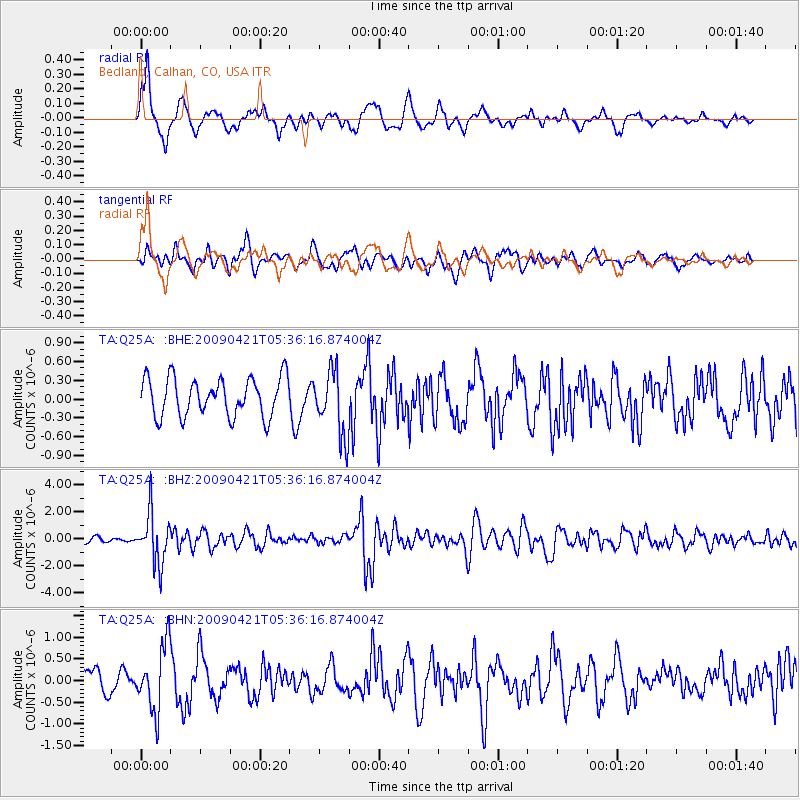
Q25A Bedland, Calhan, CO, USA - Earthquake Result Viewer
*The percent match for this event was below the threshold and hence no stack was calculated.
| Earthquake location: |
Kuril Islands |
| Earthquake latitude/longitude: |
50.8/155.0 |
| Earthquake time(UTC): |
2009/04/21 (111) 05:26:11 GMT |
| Earthquake Depth: |
152 km |
| Earthquake Magnitude: |
6.0 MB, 6.2 MW, 6.2 MW |
| Earthquake Catalog/Contributor: |
WHDF/NEIC |
|
| Network: |
TA USArray Transportable Network (new EarthScope stations) |
| Station: |
Q25A Bedland, Calhan, CO, USA |
| Lat/Lon: |
38.91 N/104.25 W |
| Elevation: |
2001 m |
|
| Distance: |
67.0 deg |
| Az: |
56.404 deg |
| Baz: |
317.385 deg |
| Ray Param: |
$rayparam |
*The percent match for this event was below the threshold and hence was not used in the summary stack. |
|
| Radial Match: |
67.75605 % |
| Radial Bump: |
400 |
| Transverse Match: |
65.05534 % |
| Transverse Bump: |
400 |
| SOD ConfigId: |
2760 |
| Insert Time: |
2010-03-06 03:06:58.198 +0000 |
| GWidth: |
2.5 |
| Max Bumps: |
400 |
| Tol: |
0.001 |
|
Signal To Noise
| Channel | StoN | STA | LTA |
| TA:Q25A: :BHZ:20090421T05:36:16.874004Z | 10.534596 | 1.8601496E-6 | 1.7657531E-7 |
| TA:Q25A: :BHN:20090421T05:36:16.874004Z | 2.0462043 | 7.5138144E-7 | 3.6720743E-7 |
| TA:Q25A: :BHE:20090421T05:36:16.874004Z | 1.7007946 | 5.2024615E-7 | 3.0588419E-7 |
| Arrivals |
| Ps | |
| PpPs | |
| PsPs/PpSs | |


