You are here: Home > Network List > CI - Caltech Regional Seismic Network Stations List
> Station SWS Sam W. Stewart, Westmorland, CA, USA > Earthquake Result Viewer
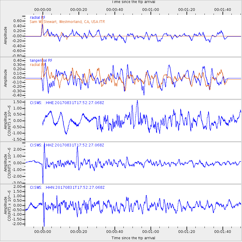
SWS Sam W. Stewart, Westmorland, CA, USA - Earthquake Result Viewer
*The percent match for this event was below the threshold and hence no stack was calculated.
| Earthquake location: |
Kodiak Island Region, Alaska |
| Earthquake latitude/longitude: |
58.5/-153.7 |
| Earthquake time(UTC): |
2017/08/31 (243) 17:46:02 GMT |
| Earthquake Depth: |
62 km |
| Earthquake Magnitude: |
5.5 ml |
| Earthquake Catalog/Contributor: |
NEIC PDE/ak |
|
| Network: |
CI Caltech Regional Seismic Network |
| Station: |
SWS Sam W. Stewart, Westmorland, CA, USA |
| Lat/Lon: |
32.94 N/115.80 W |
| Elevation: |
140 m |
|
| Distance: |
36.0 deg |
| Az: |
118.503 deg |
| Baz: |
326.669 deg |
| Ray Param: |
$rayparam |
*The percent match for this event was below the threshold and hence was not used in the summary stack. |
|
| Radial Match: |
57.929543 % |
| Radial Bump: |
400 |
| Transverse Match: |
69.0982 % |
| Transverse Bump: |
400 |
| SOD ConfigId: |
13570011 |
| Insert Time: |
2019-04-28 15:56:03.750 +0000 |
| GWidth: |
2.5 |
| Max Bumps: |
400 |
| Tol: |
0.001 |
|
Signal To Noise
| Channel | StoN | STA | LTA |
| CI:SWS: :HHZ:20170831T17:52:27.068Z | 5.7846375 | 1.1062358E-6 | 1.9123685E-7 |
| CI:SWS: :HHN:20170831T17:52:27.068Z | 2.0536163 | 6.5259565E-7 | 3.1777876E-7 |
| CI:SWS: :HHE:20170831T17:52:27.068Z | 1.0516946 | 4.4479125E-7 | 4.2292814E-7 |
| Arrivals |
| Ps | |
| PpPs | |
| PsPs/PpSs | |


