You are here: Home > Network List > G - GEOSCOPE Stations List
> Station INU Inuyama, Japan > Earthquake Result Viewer
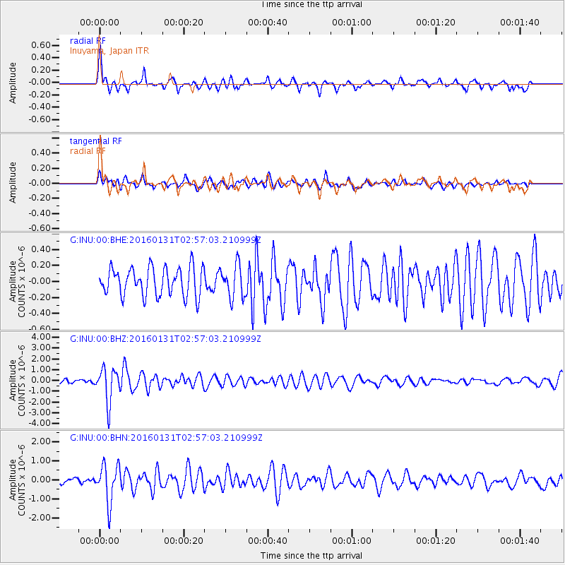
INU Inuyama, Japan - Earthquake Result Viewer
*The percent match for this event was below the threshold and hence no stack was calculated.
| Earthquake location: |
Admiralty Islands Region, P.N.G. |
| Earthquake latitude/longitude: |
-2.9/147.1 |
| Earthquake time(UTC): |
2016/01/31 (031) 02:50:06 GMT |
| Earthquake Depth: |
10 km |
| Earthquake Magnitude: |
5.6 MB |
| Earthquake Catalog/Contributor: |
NEIC PDE/NEIC ALERT |
|
| Network: |
G GEOSCOPE |
| Station: |
INU Inuyama, Japan |
| Lat/Lon: |
35.35 N/137.03 E |
| Elevation: |
132 m |
|
| Distance: |
39.2 deg |
| Az: |
346.888 deg |
| Baz: |
163.909 deg |
| Ray Param: |
$rayparam |
*The percent match for this event was below the threshold and hence was not used in the summary stack. |
|
| Radial Match: |
70.26061 % |
| Radial Bump: |
400 |
| Transverse Match: |
60.050632 % |
| Transverse Bump: |
400 |
| SOD ConfigId: |
1427151 |
| Insert Time: |
2016-02-14 03:05:30.752 +0000 |
| GWidth: |
2.5 |
| Max Bumps: |
400 |
| Tol: |
0.001 |
|
Signal To Noise
| Channel | StoN | STA | LTA |
| G:INU:00:BHZ:20160131T02:57:03.210999Z | 5.949314 | 1.6247371E-6 | 2.7309656E-7 |
| G:INU:00:BHN:20160131T02:57:03.210999Z | 6.5790844 | 1.0321356E-6 | 1.5688134E-7 |
| G:INU:00:BHE:20160131T02:57:03.210999Z | 1.1826036 | 2.0814805E-7 | 1.7600831E-7 |
| Arrivals |
| Ps | |
| PpPs | |
| PsPs/PpSs | |


