You are here: Home > Network List > TA - USArray Transportable Network (new EarthScope stations) Stations List
> Station Q25A Bedland, Calhan, CO, USA > Earthquake Result Viewer
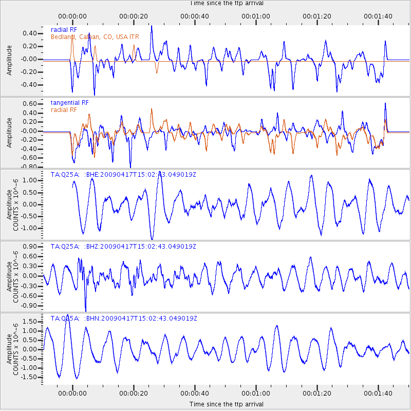
Q25A Bedland, Calhan, CO, USA - Earthquake Result Viewer
*The percent match for this event was below the threshold and hence no stack was calculated.
| Earthquake location: |
Kuril Islands |
| Earthquake latitude/longitude: |
46.2/151.7 |
| Earthquake time(UTC): |
2009/04/17 (107) 14:51:58 GMT |
| Earthquake Depth: |
49 km |
| Earthquake Magnitude: |
5.5 MB, 5.0 MS, 5.7 MW, 5.6 MW |
| Earthquake Catalog/Contributor: |
WHDF/NEIC |
|
| Network: |
TA USArray Transportable Network (new EarthScope stations) |
| Station: |
Q25A Bedland, Calhan, CO, USA |
| Lat/Lon: |
38.91 N/104.25 W |
| Elevation: |
2001 m |
|
| Distance: |
71.4 deg |
| Az: |
52.969 deg |
| Baz: |
314.672 deg |
| Ray Param: |
$rayparam |
*The percent match for this event was below the threshold and hence was not used in the summary stack. |
|
| Radial Match: |
43.227097 % |
| Radial Bump: |
400 |
| Transverse Match: |
61.636806 % |
| Transverse Bump: |
400 |
| SOD ConfigId: |
2658 |
| Insert Time: |
2010-03-06 03:07:51.943 +0000 |
| GWidth: |
2.5 |
| Max Bumps: |
400 |
| Tol: |
0.001 |
|
Signal To Noise
| Channel | StoN | STA | LTA |
| TA:Q25A: :BHZ:20090417T15:02:43.049019Z | 1.9756668 | 3.7723032E-7 | 1.9093822E-7 |
| TA:Q25A: :BHN:20090417T15:02:43.049019Z | 1.5339239 | 1.0261132E-6 | 6.6894665E-7 |
| TA:Q25A: :BHE:20090417T15:02:43.049019Z | 0.94871116 | 5.223891E-7 | 5.506303E-7 |
| Arrivals |
| Ps | |
| PpPs | |
| PsPs/PpSs | |


