I06A Prineville, OR, USA - Earthquake Result Viewer
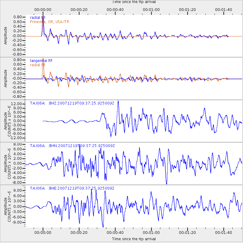
Earthquake location: Andreanof Islands, Aleutian Is.
Earthquake latitude/longitude: 51.4/-179.5
Earthquake time(UTC): 2007/12/19 (353) 09:30:27 GMT
Earthquake Depth: 29 km
Earthquake Magnitude: 6.4 MB, 7.1 MS, 7.1 MW, 7.0 MW
Earthquake Catalog/Contributor: WHDF/NEIC
Network: TA USArray Transportable Network (new EarthScope stations)
Station: I06A Prineville, OR, USA
Lat/Lon: 43.94 N/120.21 W
Elevation: 1297 m
Distance: 39.7 deg
Az: 76.744 deg
Baz: 302.35 deg
Ray Param: 0.074805
Estimated Moho Depth: 23.25 km
Estimated Crust Vp/Vs: 2.10
Assumed Crust Vp: 6.597 km/s
Estimated Crust Vs: 3.149 km/s
Estimated Crust Poisson's Ratio: 0.35
Radial Match: 86.65683 %
Radial Bump: 400
Transverse Match: 74.946495 %
Transverse Bump: 400
SOD ConfigId: 2564
Insert Time: 2010-03-06 03:08:59.840 +0000
GWidth: 2.5
Max Bumps: 400
Tol: 0.001

Signal To Noise

ChannelStoNSTALTA
TA:I06A: :BHN:20071219T09:37:25.925009Z2.2002981.2177777E-65.534603E-7
TA:I06A: :BHE:20071219T09:37:25.925009Z2.07917931.7187629E-68.2665446E-7
TA:I06A: :BHZ:20071219T09:37:25.925009Z5.9457233.1099244E-65.2305234E-7
Arrivals
Ps4.1 SECOND
PpPs10 SECOND
PsPs/PpSs14 SECOND