You are here: Home > Network List > TA - USArray Transportable Network (new EarthScope stations) Stations List
> Station A36M Sachs Harbour, NT, CAN > Earthquake Result Viewer
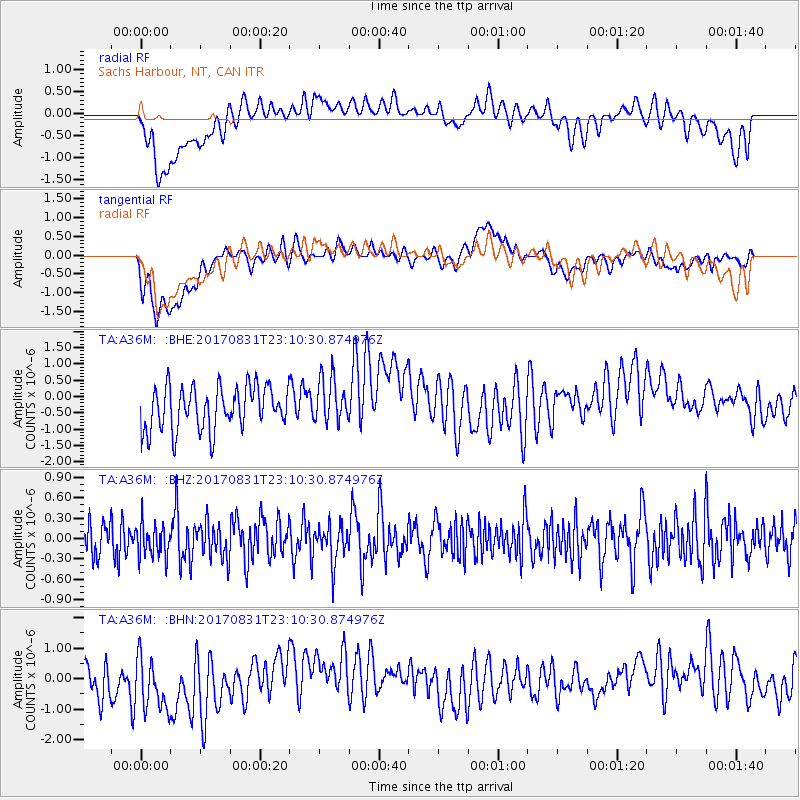
A36M Sachs Harbour, NT, CAN - Earthquake Result Viewer
*The percent match for this event was below the threshold and hence no stack was calculated.
| Earthquake location: |
Southern Molucca Sea |
| Earthquake latitude/longitude: |
-0.2/125.2 |
| Earthquake time(UTC): |
2017/08/31 (243) 22:57:39 GMT |
| Earthquake Depth: |
47 km |
| Earthquake Magnitude: |
5.4 Mww |
| Earthquake Catalog/Contributor: |
NEIC PDE/us |
|
| Network: |
TA USArray Transportable Network (new EarthScope stations) |
| Station: |
A36M Sachs Harbour, NT, CAN |
| Lat/Lon: |
71.99 N/125.25 W |
| Elevation: |
32 m |
|
| Distance: |
96.2 deg |
| Az: |
17.153 deg |
| Baz: |
288.569 deg |
| Ray Param: |
$rayparam |
*The percent match for this event was below the threshold and hence was not used in the summary stack. |
|
| Radial Match: |
38.48751 % |
| Radial Bump: |
400 |
| Transverse Match: |
42.74384 % |
| Transverse Bump: |
400 |
| SOD ConfigId: |
13570011 |
| Insert Time: |
2019-04-28 16:05:46.105 +0000 |
| GWidth: |
2.5 |
| Max Bumps: |
400 |
| Tol: |
0.001 |
|
Signal To Noise
| Channel | StoN | STA | LTA |
| TA:A36M: :BHZ:20170831T23:10:30.874976Z | 0.77694166 | 2.4586524E-7 | 3.1645263E-7 |
| TA:A36M: :BHN:20170831T23:10:30.874976Z | 1.2229748 | 1.2364611E-6 | 1.0110275E-6 |
| TA:A36M: :BHE:20170831T23:10:30.874976Z | 1.0670826 | 7.0010503E-7 | 6.560926E-7 |
| Arrivals |
| Ps | |
| PpPs | |
| PsPs/PpSs | |


