You are here: Home > Network List > TA - USArray Transportable Network (new EarthScope stations) Stations List
> Station G23K Bananza Creek, AK, USA > Earthquake Result Viewer
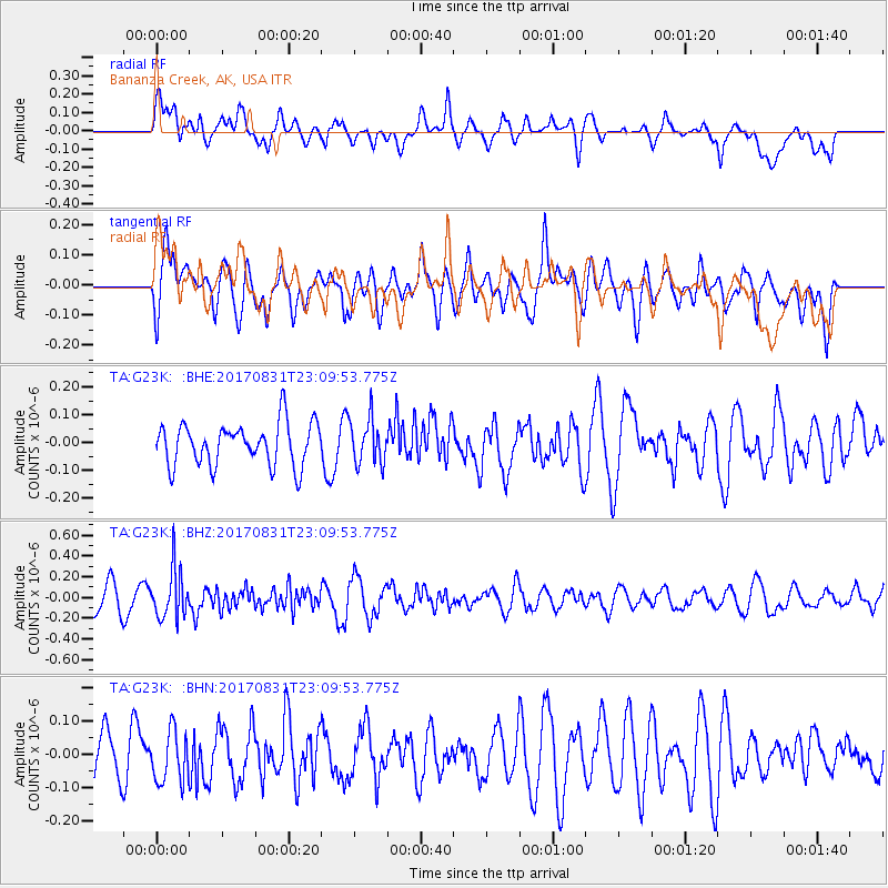
G23K Bananza Creek, AK, USA - Earthquake Result Viewer
*The percent match for this event was below the threshold and hence no stack was calculated.
| Earthquake location: |
Southern Molucca Sea |
| Earthquake latitude/longitude: |
-0.2/125.2 |
| Earthquake time(UTC): |
2017/08/31 (243) 22:57:39 GMT |
| Earthquake Depth: |
47 km |
| Earthquake Magnitude: |
5.4 Mww |
| Earthquake Catalog/Contributor: |
NEIC PDE/us |
|
| Network: |
TA USArray Transportable Network (new EarthScope stations) |
| Station: |
G23K Bananza Creek, AK, USA |
| Lat/Lon: |
66.71 N/150.02 W |
| Elevation: |
746 m |
|
| Distance: |
88.1 deg |
| Az: |
23.339 deg |
| Baz: |
265.098 deg |
| Ray Param: |
$rayparam |
*The percent match for this event was below the threshold and hence was not used in the summary stack. |
|
| Radial Match: |
53.23731 % |
| Radial Bump: |
400 |
| Transverse Match: |
53.497627 % |
| Transverse Bump: |
400 |
| SOD ConfigId: |
13570011 |
| Insert Time: |
2019-04-28 16:06:04.874 +0000 |
| GWidth: |
2.5 |
| Max Bumps: |
400 |
| Tol: |
0.001 |
|
Signal To Noise
| Channel | StoN | STA | LTA |
| TA:G23K: :BHZ:20170831T23:09:53.775Z | 1.8936205 | 2.3140834E-7 | 1.2220418E-7 |
| TA:G23K: :BHN:20170831T23:09:53.775Z | 0.6894015 | 7.731292E-8 | 1.1214498E-7 |
| TA:G23K: :BHE:20170831T23:09:53.775Z | 1.0857387 | 8.214466E-8 | 7.565785E-8 |
| Arrivals |
| Ps | |
| PpPs | |
| PsPs/PpSs | |


