I06A Prineville, OR, USA - Earthquake Result Viewer
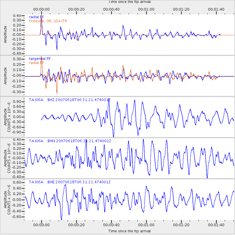
Earthquake location: New Ireland Region, P.N.G.
Earthquake latitude/longitude: -3.6/151.0
Earthquake time(UTC): 2007/06/18 (169) 06:18:48 GMT
Earthquake Depth: 26 km
Earthquake Magnitude: 5.7 MB, 6.2 MS, 6.3 MW, 6.1 MW
Earthquake Catalog/Contributor: WHDF/NEIC
Network: TA USArray Transportable Network (new EarthScope stations)
Station: I06A Prineville, OR, USA
Lat/Lon: 43.94 N/120.21 W
Elevation: 1297 m
Distance: 91.6 deg
Az: 46.26 deg
Baz: 266.637 deg
Ray Param: 0.041578192
Estimated Moho Depth: 19.0 km
Estimated Crust Vp/Vs: 1.60
Assumed Crust Vp: 6.597 km/s
Estimated Crust Vs: 4.123 km/s
Estimated Crust Poisson's Ratio: 0.18
Radial Match: 80.68035 %
Radial Bump: 400
Transverse Match: 70.99629 %
Transverse Bump: 400
SOD ConfigId: 2564
Insert Time: 2010-03-06 03:09:51.847 +0000
GWidth: 2.5
Max Bumps: 400
Tol: 0.001

Signal To Noise

ChannelStoNSTALTA
TA:I06A: :BHN:20070618T06:31:21.474001Z0.326108044.010865E-81.229919E-7
TA:I06A: :BHE:20070618T06:31:21.474001Z1.29514291.3913727E-71.0743005E-7
TA:I06A: :BHZ:20070618T06:31:21.474001Z2.46975112.782154E-71.1264916E-7
Arrivals
Ps1.8 SECOND
PpPs7.3 SECOND
PsPs/PpSs9.1 SECOND