You are here: Home > Network List > AV - Alaska Volcano Observatory Stations List
> Station SPCR Ckakachatna River, Mount Spurr, Alaska > Earthquake Result Viewer
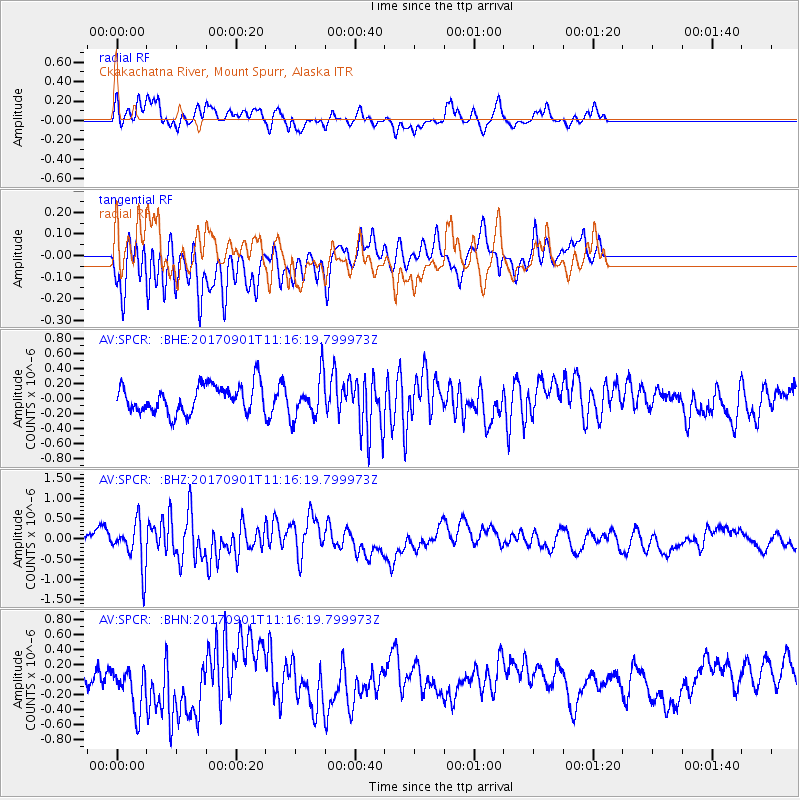
SPCR Ckakachatna River, Mount Spurr, Alaska - Earthquake Result Viewer
*The percent match for this event was below the threshold and hence no stack was calculated.
| Earthquake location: |
Reykjanes Ridge |
| Earthquake latitude/longitude: |
57.0/-34.0 |
| Earthquake time(UTC): |
2017/09/01 (244) 11:07:37 GMT |
| Earthquake Depth: |
10 km |
| Earthquake Magnitude: |
5.7 Mww |
| Earthquake Catalog/Contributor: |
NEIC PDE/us |
|
| Network: |
AV Alaska Volcano Observatory |
| Station: |
SPCR Ckakachatna River, Mount Spurr, Alaska |
| Lat/Lon: |
61.20 N/152.21 W |
| Elevation: |
984 m |
|
| Distance: |
52.6 deg |
| Az: |
327.488 deg |
| Baz: |
37.343 deg |
| Ray Param: |
$rayparam |
*The percent match for this event was below the threshold and hence was not used in the summary stack. |
|
| Radial Match: |
56.82403 % |
| Radial Bump: |
400 |
| Transverse Match: |
55.60251 % |
| Transverse Bump: |
400 |
| SOD ConfigId: |
13570011 |
| Insert Time: |
2019-04-28 16:08:42.690 +0000 |
| GWidth: |
2.5 |
| Max Bumps: |
400 |
| Tol: |
0.001 |
|
Signal To Noise
| Channel | StoN | STA | LTA |
| AV:SPCR: :BHZ:20170901T11:16:19.799973Z | 3.3246264 | 5.570392E-7 | 1.675494E-7 |
| AV:SPCR: :BHN:20170901T11:16:19.799973Z | 1.1147441 | 2.9057347E-7 | 2.6066385E-7 |
| AV:SPCR: :BHE:20170901T11:16:19.799973Z | 1.4926499 | 2.75917E-7 | 1.8485044E-7 |
| Arrivals |
| Ps | |
| PpPs | |
| PsPs/PpSs | |


