You are here: Home > Network List > AV - Alaska Volcano Observatory Stations List
> Station SPU Mount Spurr, Mount Spurr, Alaska > Earthquake Result Viewer
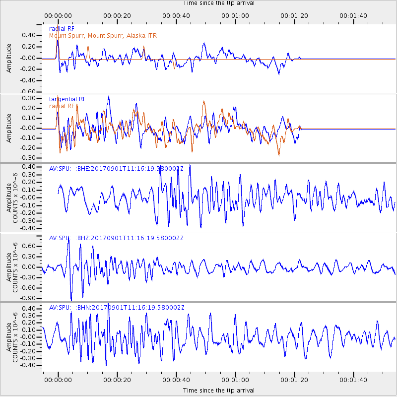
SPU Mount Spurr, Mount Spurr, Alaska - Earthquake Result Viewer
*The percent match for this event was below the threshold and hence no stack was calculated.
| Earthquake location: |
Reykjanes Ridge |
| Earthquake latitude/longitude: |
57.0/-34.0 |
| Earthquake time(UTC): |
2017/09/01 (244) 11:07:37 GMT |
| Earthquake Depth: |
10 km |
| Earthquake Magnitude: |
5.7 Mww |
| Earthquake Catalog/Contributor: |
NEIC PDE/us |
|
| Network: |
AV Alaska Volcano Observatory |
| Station: |
SPU Mount Spurr, Mount Spurr, Alaska |
| Lat/Lon: |
61.18 N/152.06 W |
| Elevation: |
800 m |
|
| Distance: |
52.5 deg |
| Az: |
327.4 deg |
| Baz: |
37.422 deg |
| Ray Param: |
$rayparam |
*The percent match for this event was below the threshold and hence was not used in the summary stack. |
|
| Radial Match: |
59.373936 % |
| Radial Bump: |
400 |
| Transverse Match: |
71.917725 % |
| Transverse Bump: |
400 |
| SOD ConfigId: |
13570011 |
| Insert Time: |
2019-04-28 16:08:43.247 +0000 |
| GWidth: |
2.5 |
| Max Bumps: |
400 |
| Tol: |
0.001 |
|
Signal To Noise
| Channel | StoN | STA | LTA |
| AV:SPU: :BHZ:20170901T11:16:19.580002Z | 3.8603055 | 3.9422966E-7 | 1.02123956E-7 |
| AV:SPU: :BHN:20170901T11:16:19.580002Z | 1.4261647 | 1.5356325E-7 | 1.0767567E-7 |
| AV:SPU: :BHE:20170901T11:16:19.580002Z | 1.7391882 | 1.8724603E-7 | 1.0766289E-7 |
| Arrivals |
| Ps | |
| PpPs | |
| PsPs/PpSs | |


