You are here: Home > Network List > CI - Caltech Regional Seismic Network Stations List
> Station BAR Barrett, Tecate, CA, USA > Earthquake Result Viewer
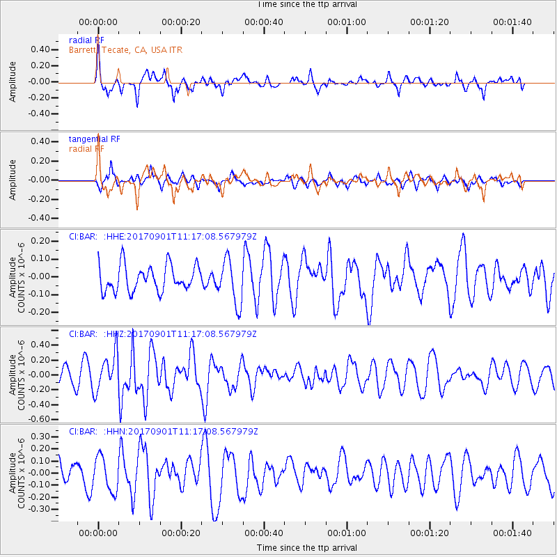
BAR Barrett, Tecate, CA, USA - Earthquake Result Viewer
*The percent match for this event was below the threshold and hence no stack was calculated.
| Earthquake location: |
Reykjanes Ridge |
| Earthquake latitude/longitude: |
57.0/-34.0 |
| Earthquake time(UTC): |
2017/09/01 (244) 11:07:37 GMT |
| Earthquake Depth: |
10 km |
| Earthquake Magnitude: |
5.7 Mww |
| Earthquake Catalog/Contributor: |
NEIC PDE/us |
|
| Network: |
CI Caltech Regional Seismic Network |
| Station: |
BAR Barrett, Tecate, CA, USA |
| Lat/Lon: |
32.68 N/116.67 W |
| Elevation: |
521 m |
|
| Distance: |
59.4 deg |
| Az: |
283.66 deg |
| Baz: |
39.027 deg |
| Ray Param: |
$rayparam |
*The percent match for this event was below the threshold and hence was not used in the summary stack. |
|
| Radial Match: |
74.54731 % |
| Radial Bump: |
400 |
| Transverse Match: |
68.12419 % |
| Transverse Bump: |
400 |
| SOD ConfigId: |
13570011 |
| Insert Time: |
2019-04-28 16:09:29.913 +0000 |
| GWidth: |
2.5 |
| Max Bumps: |
400 |
| Tol: |
0.001 |
|
Signal To Noise
| Channel | StoN | STA | LTA |
| CI:BAR: :HHZ:20170901T11:17:08.567979Z | 2.6072276 | 2.538154E-7 | 9.7350686E-8 |
| CI:BAR: :HHN:20170901T11:17:08.567979Z | 1.7500747 | 1.4476171E-7 | 8.271745E-8 |
| CI:BAR: :HHE:20170901T11:17:08.567979Z | 1.7961978 | 1.2935604E-7 | 7.201659E-8 |
| Arrivals |
| Ps | |
| PpPs | |
| PsPs/PpSs | |


