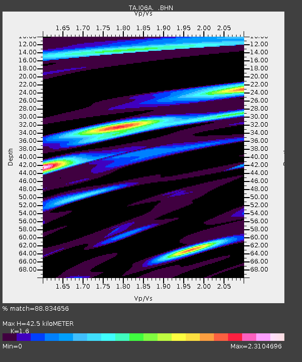
I06A Prineville, OR, USA - Earthquake Result Viewer
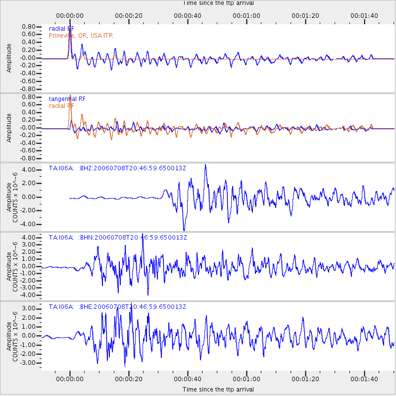
Earthquake location: Andreanof Islands, Aleutian Is.
Earthquake latitude/longitude: 51.2/-179.3
Earthquake time(UTC): 2006/07/08 (189) 20:40:00 GMT
Earthquake Depth: 22 km
Earthquake Magnitude: 6.2 MB, 6.4 MS, 6.6 MW, 6.6 MW
Earthquake Catalog/Contributor: WHDF/NEIC
Network: TA USArray Transportable Network (new EarthScope stations)
Station: I06A Prineville, OR, USA
Lat/Lon: 43.94 N/120.21 W
Elevation: 1297 m
Distance: 39.6 deg
Az: 76.696 deg
Baz: 302.074 deg
Ray Param: 0.074881196
Estimated Moho Depth: 42.5 km
Estimated Crust Vp/Vs: 1.60
Assumed Crust Vp: 6.597 km/s
Estimated Crust Vs: 4.123 km/s
Estimated Crust Poisson's Ratio: 0.18
Radial Match: 88.834656 %
Radial Bump: 400
Transverse Match: 78.04052 %
Transverse Bump: 400
SOD ConfigId: 5423
Insert Time: 2010-03-06 03:10:14.162 +0000
GWidth: 2.5
Max Bumps: 400
Tol: 0.001

Signal To Noise

ChannelStoNSTALTA
TA:I06A: :BHN:20060708T20:46:59.650013Z2.9676142.31937E-77.8156056E-8
TA:I06A: :BHE:20060708T20:46:59.650013Z1.51165432.7697706E-71.8322778E-7
TA:I06A: :BHZ:20060708T20:46:59.650013Z5.24355035.8987877E-71.1249606E-7
Arrivals
Ps4.2 SECOND
PpPs15 SECOND
PsPs/PpSs20 SECOND