
I06A Prineville, OR, USA - Earthquake Result Viewer
| ||||||||||||||||||
| ||||||||||||||||||
| ||||||||||||||||||
|
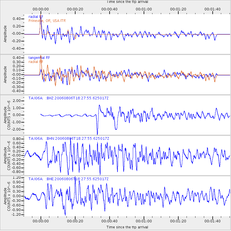
Signal To Noise
| Channel | StoN | STA | LTA |
| TA:I06A: :BHN:20060806T18:27:55.625017Z | 2.3605082 | 3.4182753E-7 | 1.44811E-7 |
| TA:I06A: :BHE:20060806T18:27:55.625017Z | 4.3310924 | 3.950069E-7 | 9.120261E-8 |
| TA:I06A: :BHZ:20060806T18:27:55.625017Z | 12.284089 | 9.621208E-7 | 7.832252E-8 |
| Arrivals | |
| Ps | 4.1 SECOND |
| PpPs | 11 SECOND |
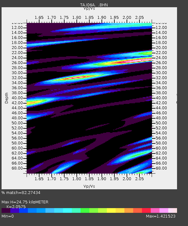
| PsPs/PpSs | 15 SECOND |

