You are here: Home > Network List > IU - Global Seismograph Network (GSN - IRIS/USGS) Stations List
> Station PMG Port Moresby, New Guinea > Earthquake Result Viewer
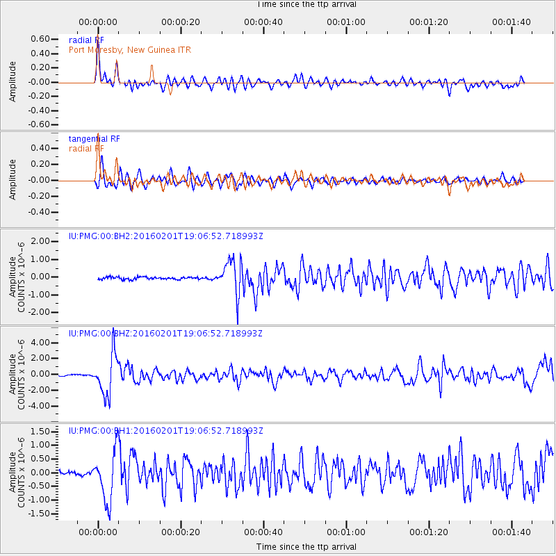
PMG Port Moresby, New Guinea - Earthquake Result Viewer
*The percent match for this event was below the threshold and hence no stack was calculated.
| Earthquake location: |
Kermadec Islands Region |
| Earthquake latitude/longitude: |
-31.0/-179.9 |
| Earthquake time(UTC): |
2016/02/01 (032) 19:00:44 GMT |
| Earthquake Depth: |
370 km |
| Earthquake Magnitude: |
5.8 MB |
| Earthquake Catalog/Contributor: |
NEIC PDE/NEIC COMCAT |
|
| Network: |
IU Global Seismograph Network (GSN - IRIS/USGS) |
| Station: |
PMG Port Moresby, New Guinea |
| Lat/Lon: |
9.40 S/147.16 E |
| Elevation: |
90 m |
|
| Distance: |
37.4 deg |
| Az: |
297.999 deg |
| Baz: |
129.785 deg |
| Ray Param: |
$rayparam |
*The percent match for this event was below the threshold and hence was not used in the summary stack. |
|
| Radial Match: |
78.2859 % |
| Radial Bump: |
400 |
| Transverse Match: |
70.52014 % |
| Transverse Bump: |
400 |
| SOD ConfigId: |
1427151 |
| Insert Time: |
2016-02-15 19:26:31.575 +0000 |
| GWidth: |
2.5 |
| Max Bumps: |
400 |
| Tol: |
0.001 |
|
Signal To Noise
| Channel | StoN | STA | LTA |
| IU:PMG:00:BHZ:20160201T19:06:52.718993Z | 18.679558 | 2.641599E-6 | 1.4141656E-7 |
| IU:PMG:00:BH1:20160201T19:06:52.718993Z | 9.151245 | 9.4831404E-7 | 1.03626775E-7 |
| IU:PMG:00:BH2:20160201T19:06:52.718993Z | 15.009273 | 9.798371E-7 | 6.528212E-8 |
| Arrivals |
| Ps | |
| PpPs | |
| PsPs/PpSs | |


