
M07A Soldier Meadows, NV, USA - Earthquake Result Viewer
| ||||||||||||||||||
| ||||||||||||||||||
| ||||||||||||||||||
|
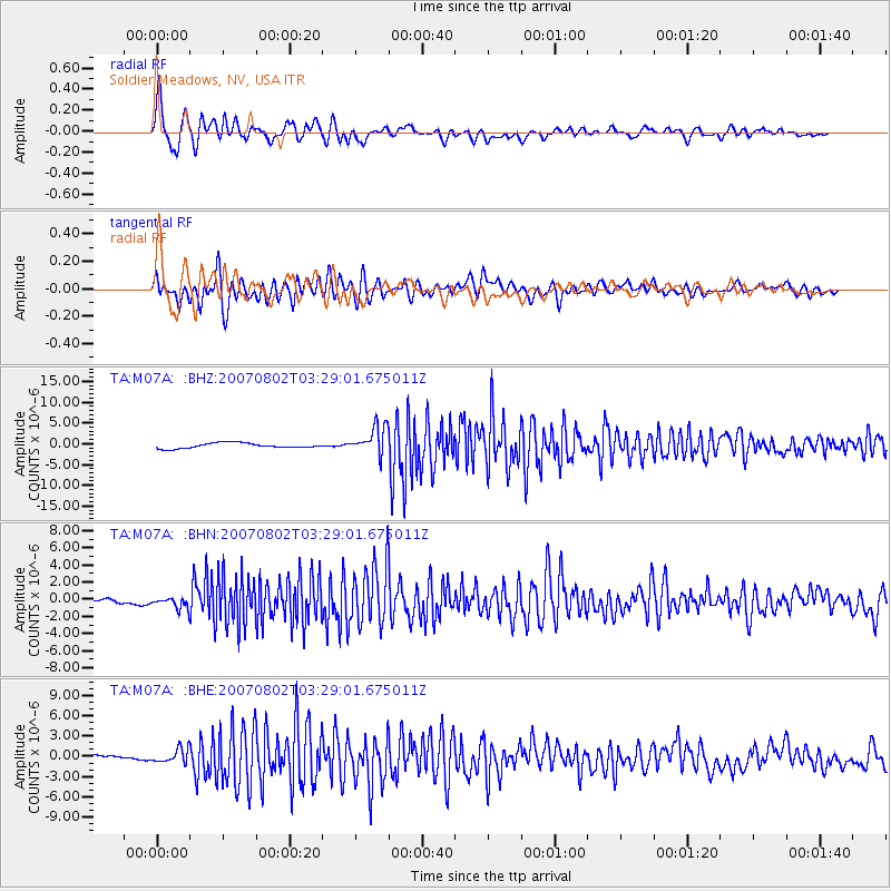
Signal To Noise
| Channel | StoN | STA | LTA |
| TA:M07A: :BHN:20070802T03:29:01.675011Z | 1.5684792 | 6.525303E-7 | 4.160274E-7 |
| TA:M07A: :BHE:20070802T03:29:01.675011Z | 1.3254433 | 1.0098419E-6 | 7.6188996E-7 |
| TA:M07A: :BHZ:20070802T03:29:01.675011Z | 5.3777204 | 3.4386871E-6 | 6.3943213E-7 |
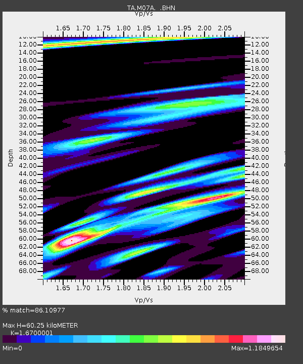
| Arrivals | |
| Ps | 6.9 SECOND |
| PpPs | 24 SECOND |
| PsPs/PpSs | 31 SECOND |

