M07A Soldier Meadows, NV, USA - Earthquake Result Viewer
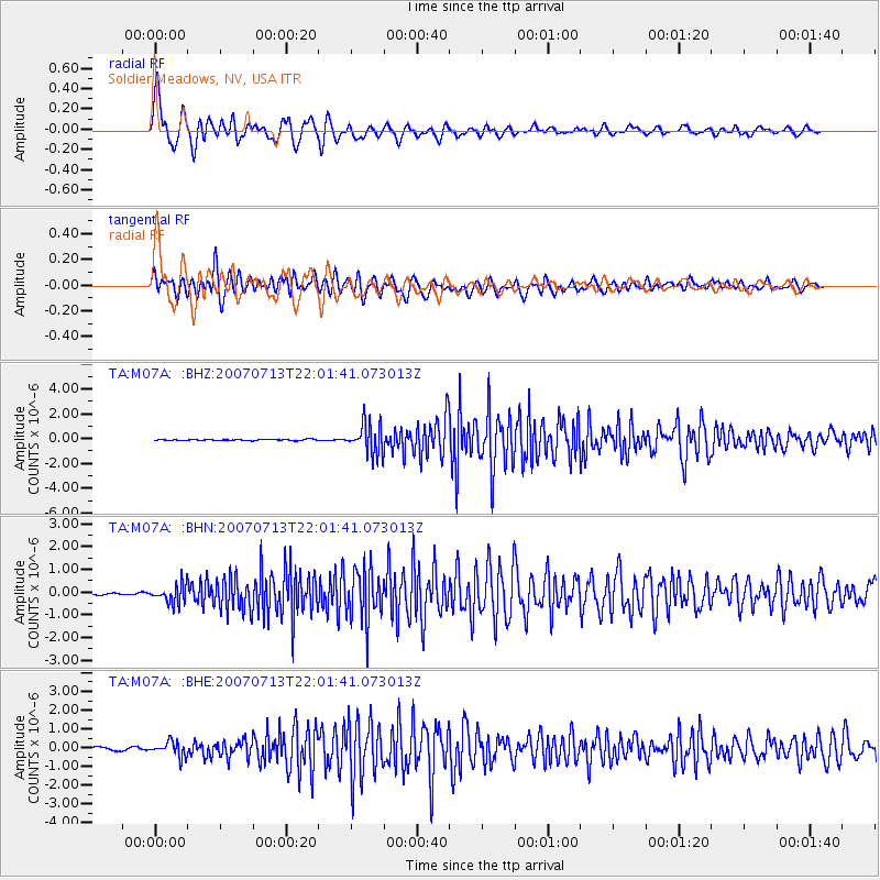
Earthquake location: Andreanof Islands, Aleutian Is.
Earthquake latitude/longitude: 51.8/-176.3
Earthquake time(UTC): 2007/07/13 (194) 21:54:43 GMT
Earthquake Depth: 35 km
Earthquake Magnitude: 5.7 MB, 5.6 MS, 6.0 MW, 5.9 MW
Earthquake Catalog/Contributor: WHDF/NEIC
Network: TA USArray Transportable Network (new EarthScope stations)
Station: M07A Soldier Meadows, NV, USA
Lat/Lon: 41.39 N/119.17 W
Elevation: 1400 m
Distance: 39.6 deg
Az: 82.052 deg
Baz: 305.248 deg
Ray Param: 0.0747982
Estimated Moho Depth: 10.0 km
Estimated Crust Vp/Vs: 1.96
Assumed Crust Vp: 6.276 km/s
Estimated Crust Vs: 3.198 km/s
Estimated Crust Poisson's Ratio: 0.32
Radial Match: 90.28617 %
Radial Bump: 400
Transverse Match: 83.14085 %
Transverse Bump: 400
SOD ConfigId: 2564
Insert Time: 2010-03-06 03:11:35.394 +0000
GWidth: 2.5
Max Bumps: 400
Tol: 0.001

Signal To Noise

ChannelStoNSTALTA
TA:M07A: :BHN:20070713T22:01:41.073013Z7.62992954.0917595E-75.362775E-8
TA:M07A: :BHE:20070713T22:01:41.073013Z4.6499153.9472178E-78.488795E-8
TA:M07A: :BHZ:20070713T22:01:41.073013Z27.6229921.197309E-64.3344652E-8
Arrivals
Ps1.6 SECOND
PpPs4.4 SECOND
PsPs/PpSs6.1 SECOND