You are here: Home > Network List > TA - USArray Transportable Network (new EarthScope stations) Stations List
> Station E20K Nigu River, AK, USA > Earthquake Result Viewer
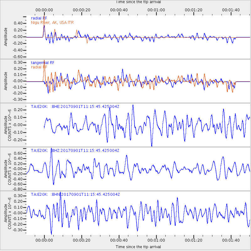
E20K Nigu River, AK, USA - Earthquake Result Viewer
*The percent match for this event was below the threshold and hence no stack was calculated.
| Earthquake location: |
Reykjanes Ridge |
| Earthquake latitude/longitude: |
57.0/-34.0 |
| Earthquake time(UTC): |
2017/09/01 (244) 11:07:37 GMT |
| Earthquake Depth: |
10 km |
| Earthquake Magnitude: |
5.7 Mww |
| Earthquake Catalog/Contributor: |
NEIC PDE/us |
|
| Network: |
TA USArray Transportable Network (new EarthScope stations) |
| Station: |
E20K Nigu River, AK, USA |
| Lat/Lon: |
68.26 N/156.19 W |
| Elevation: |
866 m |
|
| Distance: |
48.0 deg |
| Az: |
334.897 deg |
| Baz: |
38.482 deg |
| Ray Param: |
$rayparam |
*The percent match for this event was below the threshold and hence was not used in the summary stack. |
|
| Radial Match: |
58.985035 % |
| Radial Bump: |
400 |
| Transverse Match: |
66.90427 % |
| Transverse Bump: |
400 |
| SOD ConfigId: |
13570011 |
| Insert Time: |
2019-04-28 16:16:18.218 +0000 |
| GWidth: |
2.5 |
| Max Bumps: |
400 |
| Tol: |
0.001 |
|
Signal To Noise
| Channel | StoN | STA | LTA |
| TA:E20K: :BHZ:20170901T11:15:45.425004Z | 2.9990616 | 3.4302298E-7 | 1.1437677E-7 |
| TA:E20K: :BHN:20170901T11:15:45.425004Z | 1.7700869 | 1.4625013E-7 | 8.262313E-8 |
| TA:E20K: :BHE:20170901T11:15:45.425004Z | 1.8437109 | 1.1554737E-7 | 6.267109E-8 |
| Arrivals |
| Ps | |
| PpPs | |
| PsPs/PpSs | |


