You are here: Home > Network List > GS - US Geological Survey Networks Stations List
> Station DEC08 Decatur Surface Seismic Site, Decatur, IL, USA > Earthquake Result Viewer
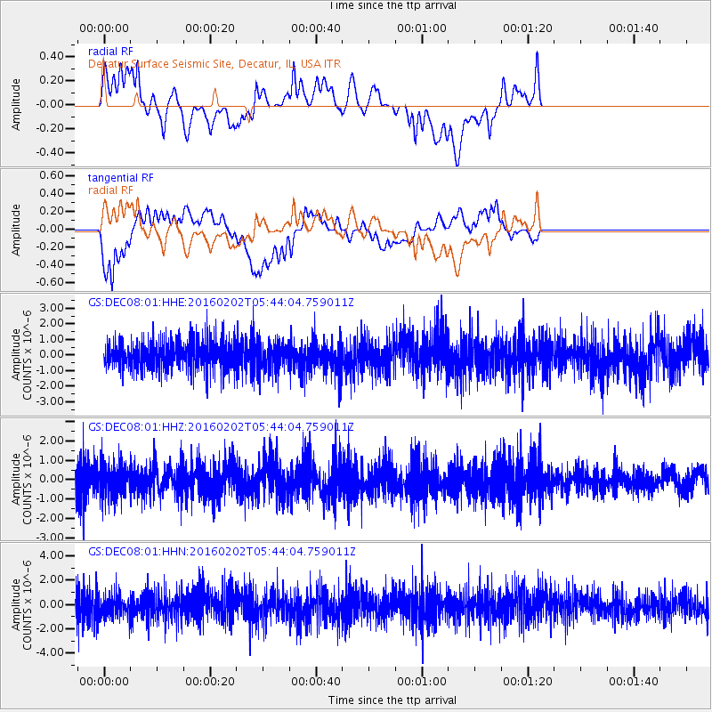
DEC08 Decatur Surface Seismic Site, Decatur, IL, USA - Earthquake Result Viewer
*The percent match for this event was below the threshold and hence no stack was calculated.
| Earthquake location: |
Near East Coast Of Honshu, Japan |
| Earthquake latitude/longitude: |
39.7/143.0 |
| Earthquake time(UTC): |
2016/02/02 (033) 05:31:48 GMT |
| Earthquake Depth: |
18 km |
| Earthquake Magnitude: |
5.6 MB |
| Earthquake Catalog/Contributor: |
NEIC PDE/NEIC COMCAT |
|
| Network: |
GS US Geological Survey Networks |
| Station: |
DEC08 Decatur Surface Seismic Site, Decatur, IL, USA |
| Lat/Lon: |
39.86 N/88.92 W |
| Elevation: |
210 m |
|
| Distance: |
87.8 deg |
| Az: |
37.301 deg |
| Baz: |
322.577 deg |
| Ray Param: |
$rayparam |
*The percent match for this event was below the threshold and hence was not used in the summary stack. |
|
| Radial Match: |
55.56566 % |
| Radial Bump: |
400 |
| Transverse Match: |
56.009823 % |
| Transverse Bump: |
400 |
| SOD ConfigId: |
1427151 |
| Insert Time: |
2016-02-16 06:21:07.135 +0000 |
| GWidth: |
2.5 |
| Max Bumps: |
400 |
| Tol: |
0.001 |
|
Signal To Noise
| Channel | StoN | STA | LTA |
| GS:DEC08:01:HHZ:20160202T05:44:04.759011Z | 1.3170319 | 8.3956263E-7 | 6.374657E-7 |
| GS:DEC08:01:HHN:20160202T05:44:04.759011Z | 1.0638789 | 9.2658917E-7 | 8.709536E-7 |
| GS:DEC08:01:HHE:20160202T05:44:04.759011Z | 0.98914623 | 9.1040687E-7 | 9.203967E-7 |
| Arrivals |
| Ps | |
| PpPs | |
| PsPs/PpSs | |


