You are here: Home > Network List > GS - US Geological Survey Networks Stations List
> Station KAN08 Pence Farm, Harper, KS, USA > Earthquake Result Viewer
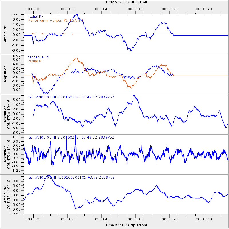
KAN08 Pence Farm, Harper, KS, USA - Earthquake Result Viewer
*The percent match for this event was below the threshold and hence no stack was calculated.
| Earthquake location: |
Near East Coast Of Honshu, Japan |
| Earthquake latitude/longitude: |
39.7/143.0 |
| Earthquake time(UTC): |
2016/02/02 (033) 05:31:48 GMT |
| Earthquake Depth: |
18 km |
| Earthquake Magnitude: |
5.6 MB |
| Earthquake Catalog/Contributor: |
NEIC PDE/NEIC COMCAT |
|
| Network: |
GS US Geological Survey Networks |
| Station: |
KAN08 Pence Farm, Harper, KS, USA |
| Lat/Lon: |
37.23 N/97.97 W |
| Elevation: |
375 m |
|
| Distance: |
85.2 deg |
| Az: |
44.432 deg |
| Baz: |
317.393 deg |
| Ray Param: |
$rayparam |
*The percent match for this event was below the threshold and hence was not used in the summary stack. |
|
| Radial Match: |
32.975338 % |
| Radial Bump: |
400 |
| Transverse Match: |
56.545372 % |
| Transverse Bump: |
400 |
| SOD ConfigId: |
1427151 |
| Insert Time: |
2016-02-16 06:21:29.697 +0000 |
| GWidth: |
2.5 |
| Max Bumps: |
400 |
| Tol: |
0.001 |
|
Signal To Noise
| Channel | StoN | STA | LTA |
| GS:KAN08:01:HHZ:20160202T05:43:52.283975Z | 1.2484748 | 2.9114577E-7 | 2.3320116E-7 |
| GS:KAN08:01:HHN:20160202T05:43:52.283975Z | 3.2824492 | 8.3501955E-6 | 2.5438917E-6 |
| GS:KAN08:01:HHE:20160202T05:43:52.283975Z | 1.9330299 | 5.1776537E-6 | 2.6785171E-6 |
| Arrivals |
| Ps | |
| PpPs | |
| PsPs/PpSs | |


