You are here: Home > Network List > TA - USArray Transportable Network (new EarthScope stations) Stations List
> Station H31M Peel River, Yukon, CAN > Earthquake Result Viewer
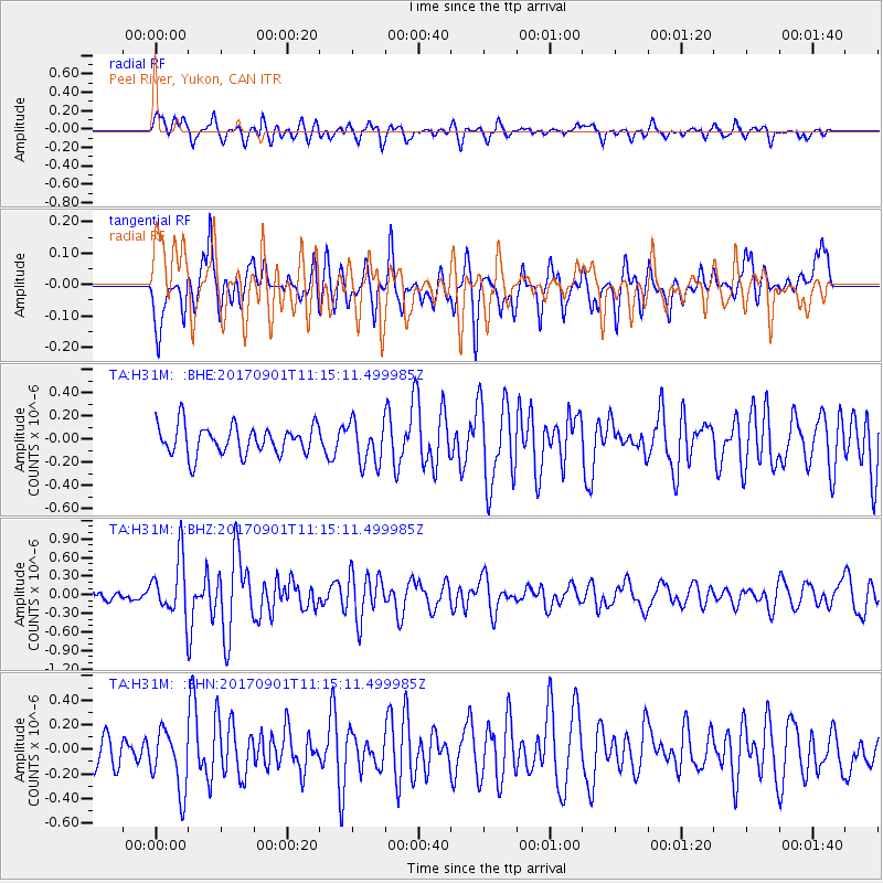
H31M Peel River, Yukon, CAN - Earthquake Result Viewer
*The percent match for this event was below the threshold and hence no stack was calculated.
| Earthquake location: |
Reykjanes Ridge |
| Earthquake latitude/longitude: |
57.0/-34.0 |
| Earthquake time(UTC): |
2017/09/01 (244) 11:07:37 GMT |
| Earthquake Depth: |
10 km |
| Earthquake Magnitude: |
5.7 Mww |
| Earthquake Catalog/Contributor: |
NEIC PDE/us |
|
| Network: |
TA USArray Transportable Network (new EarthScope stations) |
| Station: |
H31M Peel River, Yukon, CAN |
| Lat/Lon: |
65.81 N/134.34 W |
| Elevation: |
642 m |
|
| Distance: |
43.7 deg |
| Az: |
324.081 deg |
| Baz: |
51.069 deg |
| Ray Param: |
$rayparam |
*The percent match for this event was below the threshold and hence was not used in the summary stack. |
|
| Radial Match: |
59.34453 % |
| Radial Bump: |
400 |
| Transverse Match: |
59.916245 % |
| Transverse Bump: |
400 |
| SOD ConfigId: |
13570011 |
| Insert Time: |
2019-04-28 16:16:53.446 +0000 |
| GWidth: |
2.5 |
| Max Bumps: |
400 |
| Tol: |
0.001 |
|
Signal To Noise
| Channel | StoN | STA | LTA |
| TA:H31M: :BHZ:20170901T11:15:11.499985Z | 4.344751 | 4.600965E-7 | 1.0589709E-7 |
| TA:H31M: :BHN:20170901T11:15:11.499985Z | 1.7597542 | 2.4686815E-7 | 1.402856E-7 |
| TA:H31M: :BHE:20170901T11:15:11.499985Z | 1.4357553 | 1.8027978E-7 | 1.2556441E-7 |
| Arrivals |
| Ps | |
| PpPs | |
| PsPs/PpSs | |


