
M07A Soldier Meadows, NV, USA - Earthquake Result Viewer
| ||||||||||||||||||
| ||||||||||||||||||
| ||||||||||||||||||
|
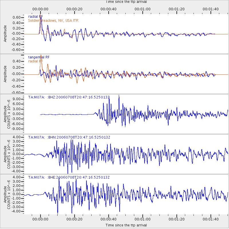
Signal To Noise
| Channel | StoN | STA | LTA |
| TA:M07A: :BHN:20060708T20:47:16.525013Z | 3.1157205 | 2.832533E-7 | 9.0911016E-8 |
| TA:M07A: :BHE:20060708T20:47:16.525013Z | 3.7341778 | 2.92645E-7 | 7.836933E-8 |
| TA:M07A: :BHZ:20060708T20:47:16.525013Z | 10.779606 | 8.786187E-7 | 8.15075E-8 |
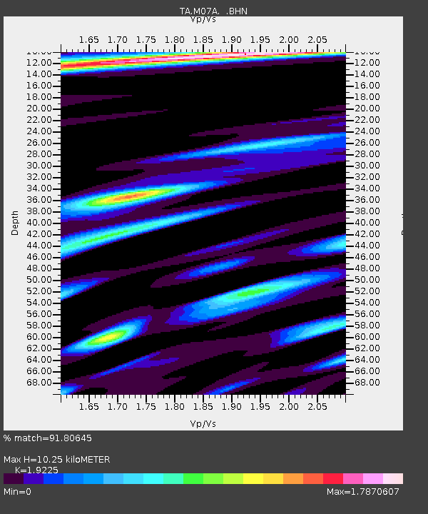
| Arrivals | |
| Ps | 1.6 SECOND |
| PpPs | 4.5 SECOND |
| PsPs/PpSs | 6.1 SECOND |

