
M07A Soldier Meadows, NV, USA - Earthquake Result Viewer
| ||||||||||||||||||
| ||||||||||||||||||
| ||||||||||||||||||
|
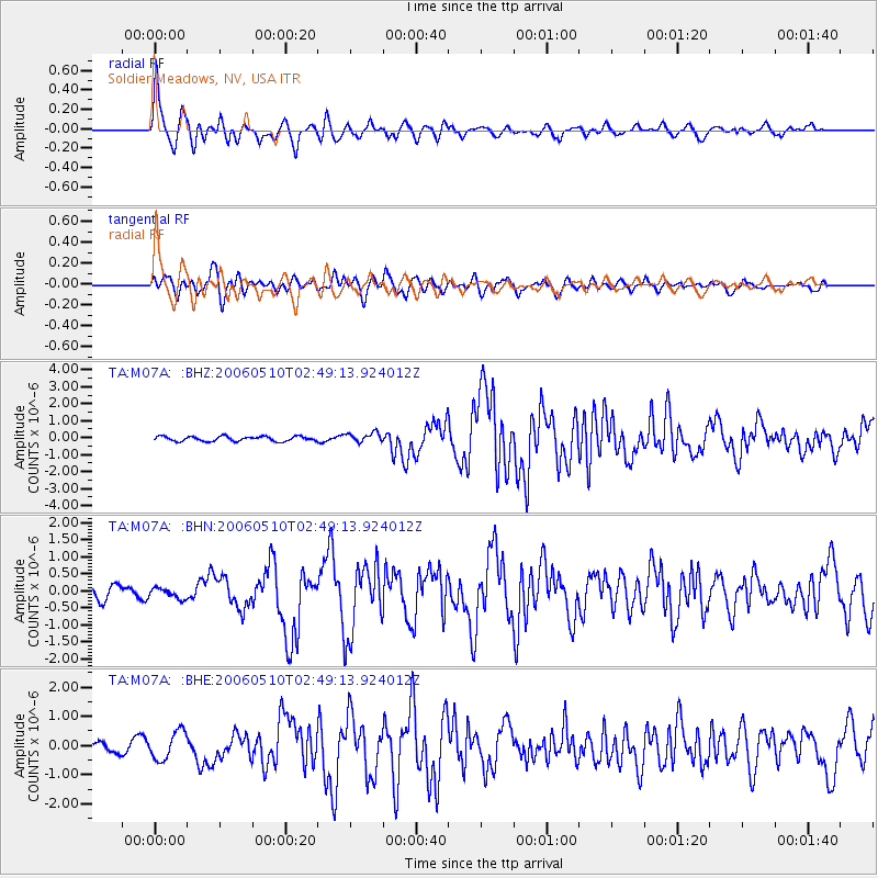
Signal To Noise
| Channel | StoN | STA | LTA |
| TA:M07A: :BHN:20060510T02:49:13.924012Z | 0.79585993 | 1.5076155E-7 | 1.8943226E-7 |
| TA:M07A: :BHE:20060510T02:49:13.924012Z | 2.9860759 | 4.846506E-7 | 1.6230352E-7 |
| TA:M07A: :BHZ:20060510T02:49:13.924012Z | 1.9818925 | 2.7896866E-7 | 1.4075871E-7 |
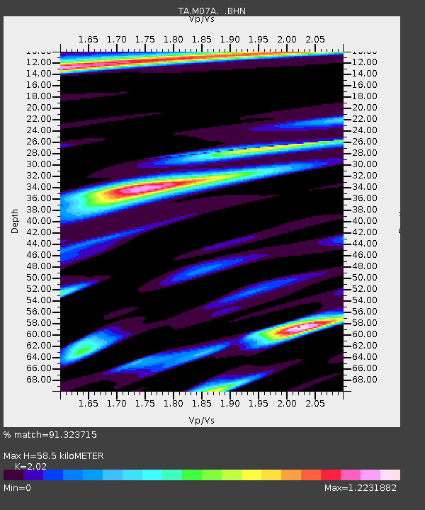
| Arrivals | |
| Ps | 10 SECOND |
| PpPs | 26 SECOND |
| PsPs/PpSs | 37 SECOND |

