You are here: Home > Network List > US - United States National Seismic Network Stations List
> Station WMOK Wichita Mountains, Oklahoma, USA > Earthquake Result Viewer
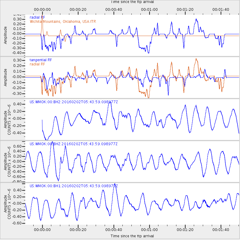
WMOK Wichita Mountains, Oklahoma, USA - Earthquake Result Viewer
*The percent match for this event was below the threshold and hence no stack was calculated.
| Earthquake location: |
Near East Coast Of Honshu, Japan |
| Earthquake latitude/longitude: |
39.7/143.0 |
| Earthquake time(UTC): |
2016/02/02 (033) 05:31:48 GMT |
| Earthquake Depth: |
18 km |
| Earthquake Magnitude: |
5.6 MB |
| Earthquake Catalog/Contributor: |
NEIC PDE/NEIC COMCAT |
|
| Network: |
US United States National Seismic Network |
| Station: |
WMOK Wichita Mountains, Oklahoma, USA |
| Lat/Lon: |
34.74 N/98.78 W |
| Elevation: |
486 m |
|
| Distance: |
86.6 deg |
| Az: |
46.606 deg |
| Baz: |
317.074 deg |
| Ray Param: |
$rayparam |
*The percent match for this event was below the threshold and hence was not used in the summary stack. |
|
| Radial Match: |
30.97624 % |
| Radial Bump: |
400 |
| Transverse Match: |
41.08785 % |
| Transverse Bump: |
400 |
| SOD ConfigId: |
1427151 |
| Insert Time: |
2016-02-16 06:29:37.821 +0000 |
| GWidth: |
2.5 |
| Max Bumps: |
400 |
| Tol: |
0.001 |
|
Signal To Noise
| Channel | StoN | STA | LTA |
| US:WMOK:00:BHZ:20160202T05:43:59.098977Z | 1.4983221 | 3.7028462E-7 | 2.4713285E-7 |
| US:WMOK:00:BH1:20160202T05:43:59.098977Z | 1.118768 | 4.8110144E-7 | 4.3002785E-7 |
| US:WMOK:00:BH2:20160202T05:43:59.098977Z | 1.130468 | 2.6330173E-7 | 2.329139E-7 |
| Arrivals |
| Ps | |
| PpPs | |
| PsPs/PpSs | |


