You are here: Home > Network List > IU - Global Seismograph Network (GSN - IRIS/USGS) Stations List
> Station JOHN Johnston Island, USA > Earthquake Result Viewer
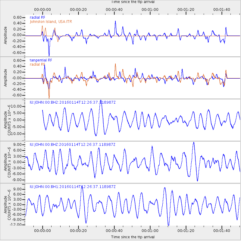
JOHN Johnston Island, USA - Earthquake Result Viewer
*The percent match for this event was below the threshold and hence no stack was calculated.
| Earthquake location: |
Macquarie Island Region |
| Earthquake latitude/longitude: |
-53.3/159.8 |
| Earthquake time(UTC): |
2016/01/14 (014) 12:15:29 GMT |
| Earthquake Depth: |
10 km |
| Earthquake Magnitude: |
5.5 MWW, 5.4 MWB, 5.5 MWC |
| Earthquake Catalog/Contributor: |
NEIC PDE/NEIC COMCAT |
|
| Network: |
IU Global Seismograph Network (GSN - IRIS/USGS) |
| Station: |
JOHN Johnston Island, USA |
| Lat/Lon: |
16.73 N/169.53 W |
| Elevation: |
2.0 m |
|
| Distance: |
74.6 deg |
| Az: |
30.516 deg |
| Baz: |
198.564 deg |
| Ray Param: |
$rayparam |
*The percent match for this event was below the threshold and hence was not used in the summary stack. |
|
| Radial Match: |
48.38832 % |
| Radial Bump: |
334 |
| Transverse Match: |
51.420475 % |
| Transverse Bump: |
350 |
| SOD ConfigId: |
1427151 |
| Insert Time: |
2016-02-16 09:51:49.318 +0000 |
| GWidth: |
2.5 |
| Max Bumps: |
400 |
| Tol: |
0.001 |
|
Signal To Noise
| Channel | StoN | STA | LTA |
| IU:JOHN:00:BHZ:20160114T12:26:37.118987Z | 1.486677 | 3.4109312E-6 | 2.2943323E-6 |
| IU:JOHN:00:BH1:20160114T12:26:37.118987Z | 1.0815231 | 4.1392436E-6 | 3.8272356E-6 |
| IU:JOHN:00:BH2:20160114T12:26:37.118987Z | 2.0573173 | 9.21461E-6 | 4.4789444E-6 |
| Arrivals |
| Ps | |
| PpPs | |
| PsPs/PpSs | |


