You are here: Home > Network List > TA - USArray Transportable Network (new EarthScope stations) Stations List
> Station E18K Tukpahlearik Creek, AK, USA > Earthquake Result Viewer
E18K Tukpahlearik Creek, AK, USA - Earthquake Result Viewer
*The percent match for this event was below the threshold and hence no stack was calculated.
| Earthquake location: |
Mariana Islands |
| Earthquake latitude/longitude: |
14.0/146.7 |
| Earthquake time(UTC): |
2017/09/02 (245) 23:00:01 GMT |
| Earthquake Depth: |
10 km |
| Earthquake Magnitude: |
5.5 mb |
| Earthquake Catalog/Contributor: |
NEIC PDE/us |
|
| Network: |
TA USArray Transportable Network (new EarthScope stations) |
| Station: |
E18K Tukpahlearik Creek, AK, USA |
| Lat/Lon: |
67.42 N/160.60 W |
| Elevation: |
297 m |
|
| Distance: |
63.3 deg |
| Az: |
20.114 deg |
| Baz: |
239.81 deg |
| Ray Param: |
$rayparam |
*The percent match for this event was below the threshold and hence was not used in the summary stack. |
|
| Radial Match: |
77.058075 % |
| Radial Bump: |
400 |
| Transverse Match: |
61.98359 % |
| Transverse Bump: |
400 |
| SOD ConfigId: |
13570011 |
| Insert Time: |
2019-04-28 16:24:19.468 +0000 |
| GWidth: |
2.5 |
| Max Bumps: |
400 |
| Tol: |
0.001 |
|
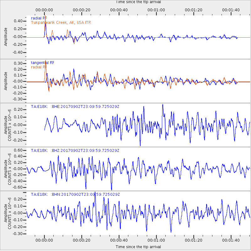
Signal To Noise
| Channel | StoN | STA | LTA |
| TA:E18K: :BHZ:20170902T23:09:59.725029Z | 1.6943979 | 1.11537176E-7 | 6.5827024E-8 |
| TA:E18K: :BHN:20170902T23:09:59.725029Z | 0.98108596 | 4.8801354E-8 | 4.974218E-8 |
| TA:E18K: :BHE:20170902T23:09:59.725029Z | 1.3167459 | 6.8055535E-8 | 5.168464E-8 |
| Arrivals |
| Ps | |
| PpPs | |
| PsPs/PpSs | |


