You are here: Home > Network List > IU - Global Seismograph Network (GSN - IRIS/USGS) Stations List
> Station CTAO Charters Towers, Australia > Earthquake Result Viewer
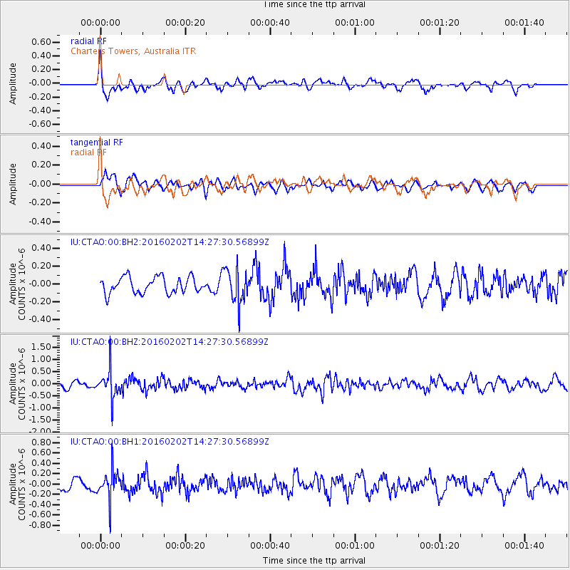
CTAO Charters Towers, Australia - Earthquake Result Viewer
*The percent match for this event was below the threshold and hence no stack was calculated.
| Earthquake location: |
Northeast Of Taiwan |
| Earthquake latitude/longitude: |
25.6/123.5 |
| Earthquake time(UTC): |
2016/02/02 (033) 14:19:22 GMT |
| Earthquake Depth: |
188 km |
| Earthquake Magnitude: |
5.8 MB, 5.7 MWB |
| Earthquake Catalog/Contributor: |
NEIC PDE/NEIC COMCAT |
|
| Network: |
IU Global Seismograph Network (GSN - IRIS/USGS) |
| Station: |
CTAO Charters Towers, Australia |
| Lat/Lon: |
20.09 S/146.25 E |
| Elevation: |
357 m |
|
| Distance: |
50.5 deg |
| Az: |
151.856 deg |
| Baz: |
333.051 deg |
| Ray Param: |
$rayparam |
*The percent match for this event was below the threshold and hence was not used in the summary stack. |
|
| Radial Match: |
59.239178 % |
| Radial Bump: |
400 |
| Transverse Match: |
70.84413 % |
| Transverse Bump: |
400 |
| SOD ConfigId: |
1427151 |
| Insert Time: |
2016-02-16 14:35:26.098 +0000 |
| GWidth: |
2.5 |
| Max Bumps: |
400 |
| Tol: |
0.001 |
|
Signal To Noise
| Channel | StoN | STA | LTA |
| IU:CTAO:00:BHZ:20160202T14:27:30.56899Z | 4.696422 | 6.100276E-7 | 1.2989199E-7 |
| IU:CTAO:00:BH1:20160202T14:27:30.56899Z | 2.3975642 | 2.8815964E-7 | 1.201885E-7 |
| IU:CTAO:00:BH2:20160202T14:27:30.56899Z | 2.1318374 | 1.9186125E-7 | 8.999807E-8 |
| Arrivals |
| Ps | |
| PpPs | |
| PsPs/PpSs | |


