You are here: Home > Network List > IU - Global Seismograph Network (GSN - IRIS/USGS) Stations List
> Station PMG Port Moresby, New Guinea > Earthquake Result Viewer
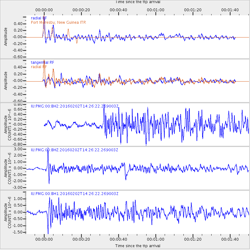
PMG Port Moresby, New Guinea - Earthquake Result Viewer
*The percent match for this event was below the threshold and hence no stack was calculated.
| Earthquake location: |
Northeast Of Taiwan |
| Earthquake latitude/longitude: |
25.6/123.5 |
| Earthquake time(UTC): |
2016/02/02 (033) 14:19:22 GMT |
| Earthquake Depth: |
188 km |
| Earthquake Magnitude: |
5.8 MB, 5.7 MWB |
| Earthquake Catalog/Contributor: |
NEIC PDE/NEIC COMCAT |
|
| Network: |
IU Global Seismograph Network (GSN - IRIS/USGS) |
| Station: |
PMG Port Moresby, New Guinea |
| Lat/Lon: |
9.40 S/147.16 E |
| Elevation: |
90 m |
|
| Distance: |
41.7 deg |
| Az: |
143.441 deg |
| Baz: |
326.966 deg |
| Ray Param: |
$rayparam |
*The percent match for this event was below the threshold and hence was not used in the summary stack. |
|
| Radial Match: |
78.4871 % |
| Radial Bump: |
400 |
| Transverse Match: |
77.83554 % |
| Transverse Bump: |
400 |
| SOD ConfigId: |
1427151 |
| Insert Time: |
2016-02-16 14:35:54.430 +0000 |
| GWidth: |
2.5 |
| Max Bumps: |
400 |
| Tol: |
0.001 |
|
Signal To Noise
| Channel | StoN | STA | LTA |
| IU:PMG:00:BHZ:20160202T14:26:22.269003Z | 9.970211 | 9.3223986E-7 | 9.3502514E-8 |
| IU:PMG:00:BH1:20160202T14:26:22.269003Z | 9.019724 | 5.916341E-7 | 6.559337E-8 |
| IU:PMG:00:BH2:20160202T14:26:22.269003Z | 3.4419827 | 2.620487E-7 | 7.613307E-8 |
| Arrivals |
| Ps | |
| PpPs | |
| PsPs/PpSs | |


