You are here: Home > Network List > TA - USArray Transportable Network (new EarthScope stations) Stations List
> Station D25K Kavik River, AK, USA > Earthquake Result Viewer
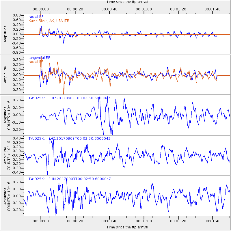
D25K Kavik River, AK, USA - Earthquake Result Viewer
*The percent match for this event was below the threshold and hence no stack was calculated.
| Earthquake location: |
Eastern Idaho |
| Earthquake latitude/longitude: |
42.6/-111.4 |
| Earthquake time(UTC): |
2017/09/02 (245) 23:56:52 GMT |
| Earthquake Depth: |
9.6 km |
| Earthquake Magnitude: |
5.4 Ml |
| Earthquake Catalog/Contributor: |
NEIC PDE/us |
|
| Network: |
TA USArray Transportable Network (new EarthScope stations) |
| Station: |
D25K Kavik River, AK, USA |
| Lat/Lon: |
69.32 N/146.38 W |
| Elevation: |
770 m |
|
| Distance: |
32.3 deg |
| Az: |
337.582 deg |
| Baz: |
127.602 deg |
| Ray Param: |
$rayparam |
*The percent match for this event was below the threshold and hence was not used in the summary stack. |
|
| Radial Match: |
63.157856 % |
| Radial Bump: |
400 |
| Transverse Match: |
65.80982 % |
| Transverse Bump: |
400 |
| SOD ConfigId: |
13570011 |
| Insert Time: |
2019-04-28 16:28:52.986 +0000 |
| GWidth: |
2.5 |
| Max Bumps: |
400 |
| Tol: |
0.001 |
|
Signal To Noise
| Channel | StoN | STA | LTA |
| TA:D25K: :BHZ:20170903T00:02:50.600004Z | 2.526265 | 1.4664822E-7 | 5.8049427E-8 |
| TA:D25K: :BHN:20170903T00:02:50.600004Z | 1.2727431 | 8.369006E-8 | 6.575566E-8 |
| TA:D25K: :BHE:20170903T00:02:50.600004Z | 2.178676 | 1.2057174E-7 | 5.534175E-8 |
| Arrivals |
| Ps | |
| PpPs | |
| PsPs/PpSs | |


