You are here: Home > Network List > TA - USArray Transportable Network (new EarthScope stations) Stations List
> Station E20K Nigu River, AK, USA > Earthquake Result Viewer
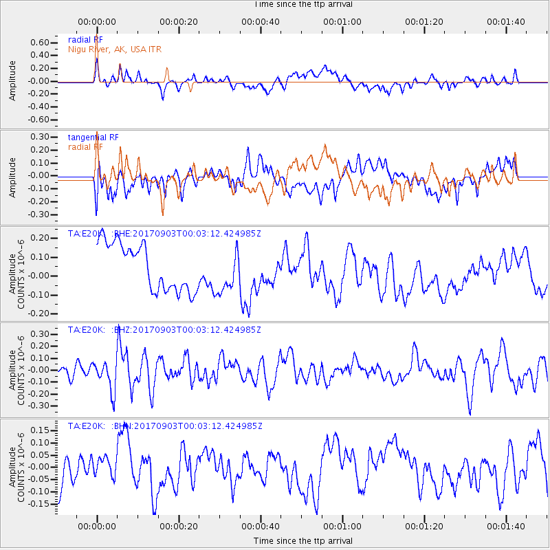
E20K Nigu River, AK, USA - Earthquake Result Viewer
*The percent match for this event was below the threshold and hence no stack was calculated.
| Earthquake location: |
Eastern Idaho |
| Earthquake latitude/longitude: |
42.6/-111.4 |
| Earthquake time(UTC): |
2017/09/02 (245) 23:56:52 GMT |
| Earthquake Depth: |
9.6 km |
| Earthquake Magnitude: |
5.4 Ml |
| Earthquake Catalog/Contributor: |
NEIC PDE/us |
|
| Network: |
TA USArray Transportable Network (new EarthScope stations) |
| Station: |
E20K Nigu River, AK, USA |
| Lat/Lon: |
68.26 N/156.19 W |
| Elevation: |
866 m |
|
| Distance: |
34.8 deg |
| Az: |
332.602 deg |
| Baz: |
114.304 deg |
| Ray Param: |
$rayparam |
*The percent match for this event was below the threshold and hence was not used in the summary stack. |
|
| Radial Match: |
32.191376 % |
| Radial Bump: |
400 |
| Transverse Match: |
36.70177 % |
| Transverse Bump: |
400 |
| SOD ConfigId: |
13570011 |
| Insert Time: |
2019-04-28 16:28:53.994 +0000 |
| GWidth: |
2.5 |
| Max Bumps: |
400 |
| Tol: |
0.001 |
|
Signal To Noise
| Channel | StoN | STA | LTA |
| TA:E20K: :BHZ:20170903T00:03:12.424985Z | 2.2769437 | 1.2511832E-7 | 5.4950117E-8 |
| TA:E20K: :BHN:20170903T00:03:12.424985Z | 0.37772888 | 3.631358E-8 | 9.613663E-8 |
| TA:E20K: :BHE:20170903T00:03:12.424985Z | 0.89085925 | 1.1077057E-7 | 1.2434127E-7 |
| Arrivals |
| Ps | |
| PpPs | |
| PsPs/PpSs | |


