You are here: Home > Network List > IW - Intermountain West Stations List
> Station DLMT Dillon, Montana, USA > Earthquake Result Viewer
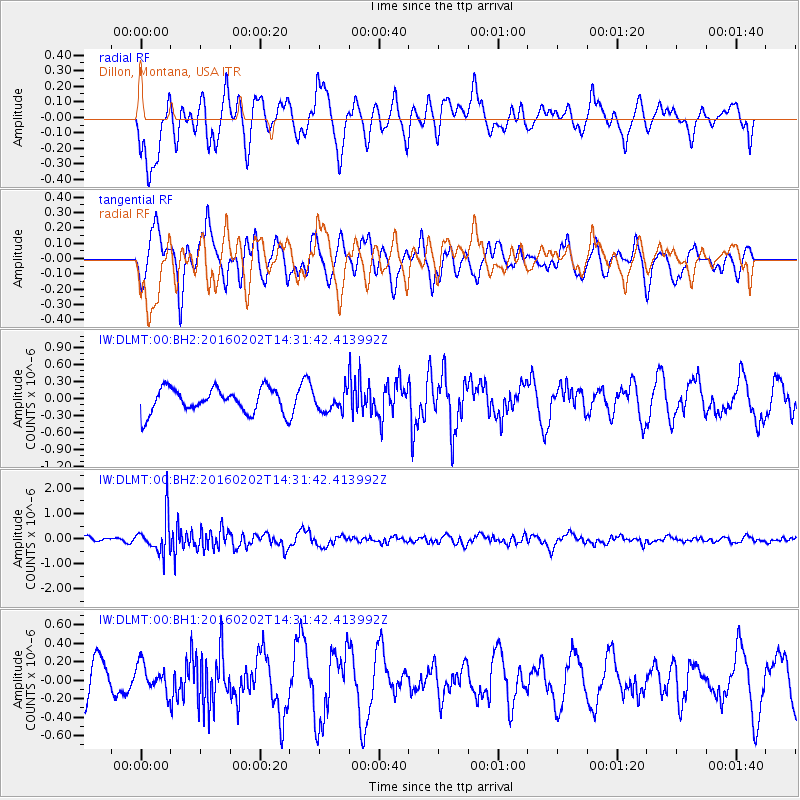
DLMT Dillon, Montana, USA - Earthquake Result Viewer
*The percent match for this event was below the threshold and hence no stack was calculated.
| Earthquake location: |
Northeast Of Taiwan |
| Earthquake latitude/longitude: |
25.6/123.5 |
| Earthquake time(UTC): |
2016/02/02 (033) 14:19:22 GMT |
| Earthquake Depth: |
188 km |
| Earthquake Magnitude: |
5.8 MB, 5.7 MWB |
| Earthquake Catalog/Contributor: |
NEIC PDE/NEIC COMCAT |
|
| Network: |
IW Intermountain West |
| Station: |
DLMT Dillon, Montana, USA |
| Lat/Lon: |
45.36 N/112.60 W |
| Elevation: |
1569 m |
|
| Distance: |
92.9 deg |
| Az: |
35.85 deg |
| Baz: |
311.393 deg |
| Ray Param: |
$rayparam |
*The percent match for this event was below the threshold and hence was not used in the summary stack. |
|
| Radial Match: |
60.567173 % |
| Radial Bump: |
400 |
| Transverse Match: |
63.12354 % |
| Transverse Bump: |
400 |
| SOD ConfigId: |
1427151 |
| Insert Time: |
2016-02-16 14:36:25.148 +0000 |
| GWidth: |
2.5 |
| Max Bumps: |
400 |
| Tol: |
0.001 |
|
Signal To Noise
| Channel | StoN | STA | LTA |
| IW:DLMT:00:BHZ:20160202T14:31:42.413992Z | 4.1360865 | 7.2751226E-7 | 1.7589387E-7 |
| IW:DLMT:00:BH1:20160202T14:31:42.413992Z | 0.71812195 | 1.4722136E-7 | 2.0500886E-7 |
| IW:DLMT:00:BH2:20160202T14:31:42.413992Z | 0.8196368 | 1.7694286E-7 | 2.1587958E-7 |
| Arrivals |
| Ps | |
| PpPs | |
| PsPs/PpSs | |


