M03C McCloud, CA, USA - Earthquake Result Viewer
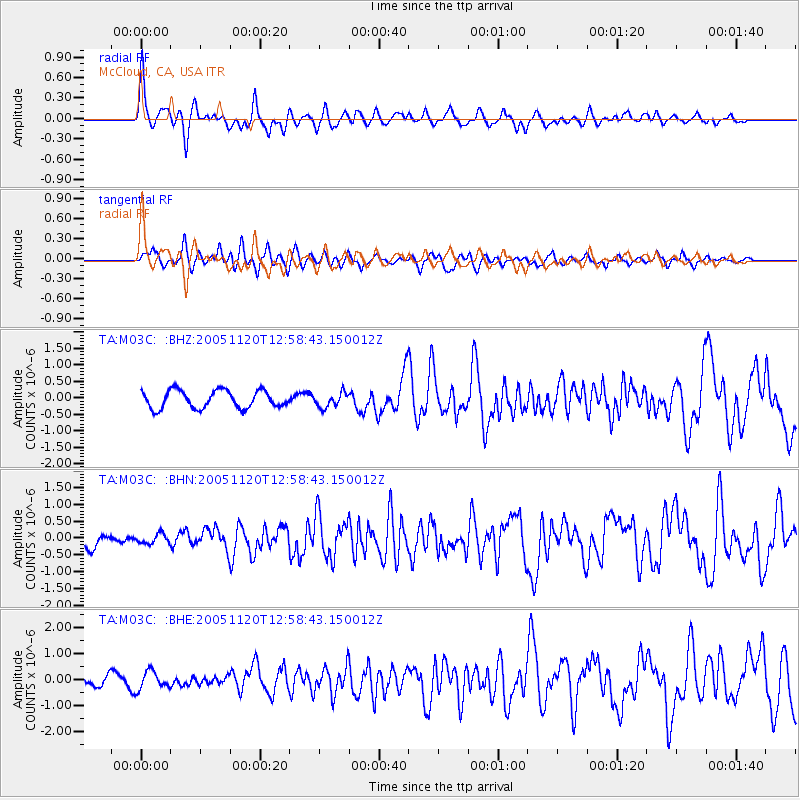
Earthquake location: Unimak Island Region, Alaska
Earthquake latitude/longitude: 53.8/-164.1
Earthquake time(UTC): 2005/11/20 (324) 12:53:02 GMT
Earthquake Depth: 30 km
Earthquake Magnitude: 5.7 MB, 5.8 MS, 6.2 MW, 6.0 MW
Earthquake Catalog/Contributor: WHDF/NEIC
Network: TA USArray Transportable Network (new EarthScope stations)
Station: M03C McCloud, CA, USA
Lat/Lon: 41.27 N/122.12 W
Elevation: 1047 m
Distance: 30.5 deg
Az: 97.011 deg
Baz: 308.712 deg
Ray Param: 0.0792833
Estimated Moho Depth: 48.25 km
Estimated Crust Vp/Vs: 1.86
Assumed Crust Vp: 6.566 km/s
Estimated Crust Vs: 3.535 km/s
Estimated Crust Poisson's Ratio: 0.30
Radial Match: 82.92599 %
Radial Bump: 400
Transverse Match: 70.06567 %
Transverse Bump: 400
SOD ConfigId: 132717
Insert Time: 2010-03-06 03:14:53.688 +0000
GWidth: 2.5
Max Bumps: 400
Tol: 0.001

Signal To Noise

ChannelStoNSTALTA
TA:M03C: :BHN:20051120T12:58:43.150012Z0.67449341.4331657E-72.1248032E-7
TA:M03C: :BHE:20051120T12:58:43.150012Z2.03577283.432167E-71.6859283E-7
TA:M03C: :BHZ:20051120T12:58:43.150012Z0.81985962.1785445E-72.6572164E-7
Arrivals
Ps6.8 SECOND
PpPs19 SECOND
PsPs/PpSs26 SECOND