You are here: Home > Network List > US - United States National Seismic Network Stations List
> Station HAWA Hanford, Washington, USA > Earthquake Result Viewer
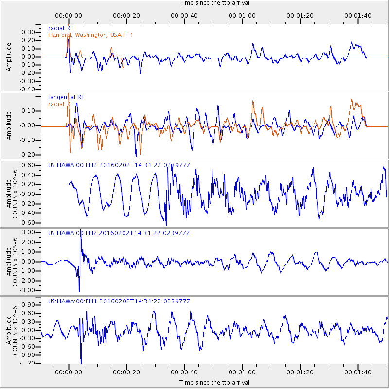
HAWA Hanford, Washington, USA - Earthquake Result Viewer
*The percent match for this event was below the threshold and hence no stack was calculated.
| Earthquake location: |
Northeast Of Taiwan |
| Earthquake latitude/longitude: |
25.6/123.5 |
| Earthquake time(UTC): |
2016/02/02 (033) 14:19:22 GMT |
| Earthquake Depth: |
188 km |
| Earthquake Magnitude: |
5.8 MB, 5.7 MWB |
| Earthquake Catalog/Contributor: |
NEIC PDE/NEIC COMCAT |
|
| Network: |
US United States National Seismic Network |
| Station: |
HAWA Hanford, Washington, USA |
| Lat/Lon: |
46.39 N/119.53 W |
| Elevation: |
364 m |
|
| Distance: |
88.5 deg |
| Az: |
38.091 deg |
| Baz: |
306.399 deg |
| Ray Param: |
$rayparam |
*The percent match for this event was below the threshold and hence was not used in the summary stack. |
|
| Radial Match: |
47.95697 % |
| Radial Bump: |
400 |
| Transverse Match: |
43.22782 % |
| Transverse Bump: |
385 |
| SOD ConfigId: |
1427151 |
| Insert Time: |
2016-02-16 14:38:16.810 +0000 |
| GWidth: |
2.5 |
| Max Bumps: |
400 |
| Tol: |
0.001 |
|
Signal To Noise
| Channel | StoN | STA | LTA |
| US:HAWA:00:BHZ:20160202T14:31:22.023977Z | 6.485012 | 1.1388702E-6 | 1.7561574E-7 |
| US:HAWA:00:BH1:20160202T14:31:22.023977Z | 1.2948893 | 3.2418623E-7 | 2.5035826E-7 |
| US:HAWA:00:BH2:20160202T14:31:22.023977Z | 1.3539929 | 3.7591724E-7 | 2.7763605E-7 |
| Arrivals |
| Ps | |
| PpPs | |
| PsPs/PpSs | |


