M03C McCloud, CA, USA - Earthquake Result Viewer
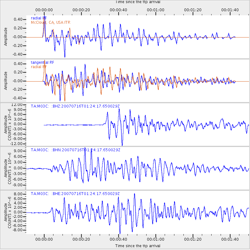
Earthquake location: Near West Coast Of Honshu, Japan
Earthquake latitude/longitude: 37.5/138.4
Earthquake time(UTC): 2007/07/16 (197) 01:13:22 GMT
Earthquake Depth: 12 km
Earthquake Magnitude: 6.5 MB, 6.4 MS, 6.6 MW, 6.5 MW
Earthquake Catalog/Contributor: WHDF/NEIC
Network: TA USArray Transportable Network (new EarthScope stations)
Station: M03C McCloud, CA, USA
Lat/Lon: 41.27 N/122.12 W
Elevation: 1047 m
Distance: 72.5 deg
Az: 51.223 deg
Baz: 304.694 deg
Ray Param: 0.053606775
Estimated Moho Depth: 60.5 km
Estimated Crust Vp/Vs: 2.03
Assumed Crust Vp: 6.566 km/s
Estimated Crust Vs: 3.243 km/s
Estimated Crust Poisson's Ratio: 0.34
Radial Match: 88.50267 %
Radial Bump: 400
Transverse Match: 89.52009 %
Transverse Bump: 400
SOD ConfigId: 2564
Insert Time: 2010-03-06 03:15:38.025 +0000
GWidth: 2.5
Max Bumps: 400
Tol: 0.001

Signal To Noise

ChannelStoNSTALTA
TA:M03C: :BHN:20070716T01:24:17.650029Z6.73615035.6095774E-78.3275715E-8
TA:M03C: :BHE:20070716T01:24:17.650029Z7.9460528.0275504E-71.0102564E-7
TA:M03C: :BHZ:20070716T01:24:17.650029Z47.5462652.7299202E-65.741608E-8
Arrivals
Ps9.7 SECOND
PpPs27 SECOND
PsPs/PpSs37 SECOND