
M03C McCloud, CA, USA - Earthquake Result Viewer
| ||||||||||||||||||
| ||||||||||||||||||
| ||||||||||||||||||
|
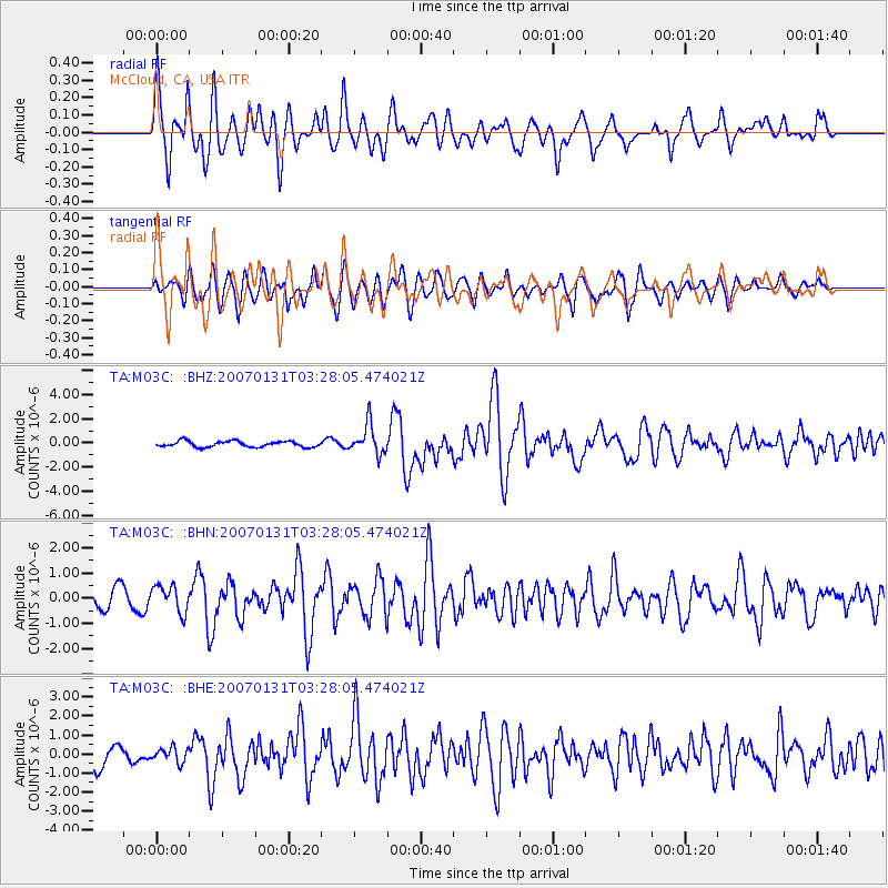
Signal To Noise
| Channel | StoN | STA | LTA |
| TA:M03C: :BHN:20070131T03:28:05.474021Z | 1.5655034 | 5.2608823E-7 | 3.3605053E-7 |
| TA:M03C: :BHE:20070131T03:28:05.474021Z | 0.79216355 | 3.7409438E-7 | 4.7224387E-7 |
| TA:M03C: :BHZ:20070131T03:28:05.474021Z | 5.169366 | 1.2366382E-6 | 2.3922436E-7 |
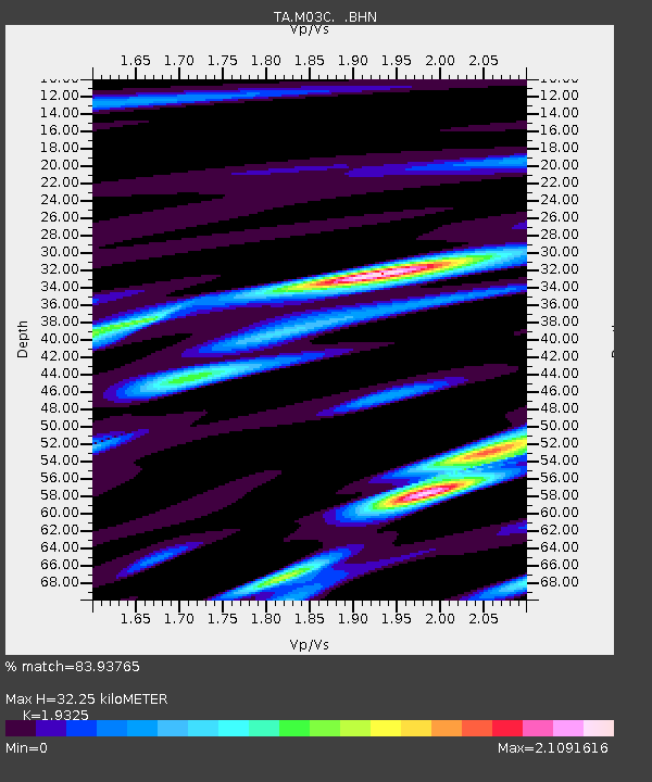
| Arrivals | |
| Ps | 4.7 SECOND |
| PpPs | 14 SECOND |
| PsPs/PpSs | 19 SECOND |

