You are here: Home > Network List > TA - USArray Transportable Network (new EarthScope stations) Stations List
> Station M03C McCloud, CA, USA > Earthquake Result Viewer
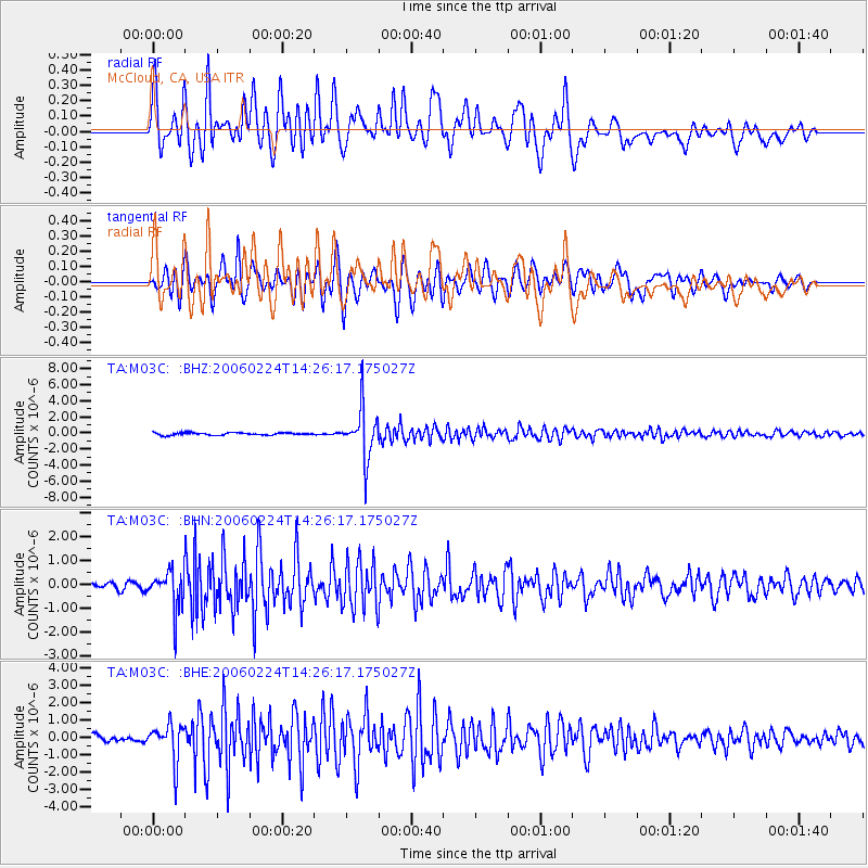
M03C McCloud, CA, USA - Earthquake Result Viewer

| Earthquake location: |
Fiji Islands Region |
| Earthquake latitude/longitude: |
-18.0/-179.6 |
| Earthquake time(UTC): |
2006/02/24 (055) 14:15:45 GMT |
| Earthquake Depth: |
622 km |
| Earthquake Magnitude: |
5.9 MB, 6.1 MW, 6.0 MW |
| Earthquake Catalog/Contributor: |
WHDF/NEIC |
|
| Network: |
TA USArray Transportable Network (new EarthScope stations) |
| Station: |
M03C McCloud, CA, USA |
| Lat/Lon: |
41.27 N/122.12 W |
| Elevation: |
1047 m |
|
| Distance: |
79.4 deg |
| Az: |
40.28 deg |
| Baz: |
234.716 deg |
| Ray Param: |
0.04702703 |
| Estimated Moho Depth: |
58.25 km |
| Estimated Crust Vp/Vs: |
1.95 |
| Assumed Crust Vp: |
6.566 km/s |
| Estimated Crust Vs: |
3.367 km/s |
| Estimated Crust Poisson's Ratio: |
0.32 |
|
| Radial Match: |
83.828186 % |
| Radial Bump: |
400 |
| Transverse Match: |
85.06896 % |
| Transverse Bump: |
400 |
| SOD ConfigId: |
2422 |
| Insert Time: |
2010-03-06 03:16:38.088 +0000 |
| GWidth: |
2.5 |
| Max Bumps: |
400 |
| Tol: |
0.001 |
|
Signal To Noise
| Channel | StoN | STA | LTA |
| TA:M03C: :BHN:20060224T14:26:17.175027Z | 5.499774 | 8.302999E-7 | 1.5096981E-7 |
| TA:M03C: :BHE:20060224T14:26:17.175027Z | 5.0747614 | 1.0798128E-6 | 2.12781E-7 |
| TA:M03C: :BHZ:20060224T14:26:17.175027Z | 20.648869 | 3.115728E-6 | 1.5089098E-7 |
| Arrivals |
| Ps | 8.6 SECOND |
| PpPs | 26 SECOND |
| PsPs/PpSs | 34 SECOND |


